Guangxi
Guangxi Zhuang Autonomous Region


The Guangxi Zhuang Autonomous Region is located in the southern part of China.
It has massive deposits of Permian limestone and a humid subtropical climate.
As a result, the limestone is heavily karstified.
Actually the karst is in a rather late state, where many caves have actually lost their roof and form now gorges and valleys.
The separated pieces of limestone were rounded and form now towers or cones.
There are several names for this late stage tropical karstification like
 Tower Karst
or cone karst.
The caves have passages of enormous size, often 50 m or even 100 m high.
There are enormous dolines which are named
Tiankeng.
Actually this province is the type locale for this name.
Tower Karst
or cone karst.
The caves have passages of enormous size, often 50 m or even 100 m high.
There are enormous dolines which are named
Tiankeng.
Actually this province is the type locale for this name.
And the province has the fourth-longest cave of China called the 江洲地下长廊 (Jiāngzhōu dìxià cháng láng, Jiangzhou Underground Corridor) or 江洲洞 (Jiāngzhōu dòng, Jiangzhou Cave).
It has a length of 53 km, 15 entrances, and 25 chambers with more than 5,000 m².
Several entrances are geosites of the China Leye-Fengshan UNESCO World Geopark with trails and educational signs in  and
and  .
Unfortunately there is no show cave so we have not listed this cave.
As mentioned there is a spectacular UNESCO World Geopark with more than 1,000 km² of karst.
Unfortunately their website has been defunct since 2023, so it is impossible to get detailed info on their geosites.
To be true, it was not very informative before it crashed.
.
Unfortunately there is no show cave so we have not listed this cave.
As mentioned there is a spectacular UNESCO World Geopark with more than 1,000 km² of karst.
Unfortunately their website has been defunct since 2023, so it is impossible to get detailed info on their geosites.
To be true, it was not very informative before it crashed.
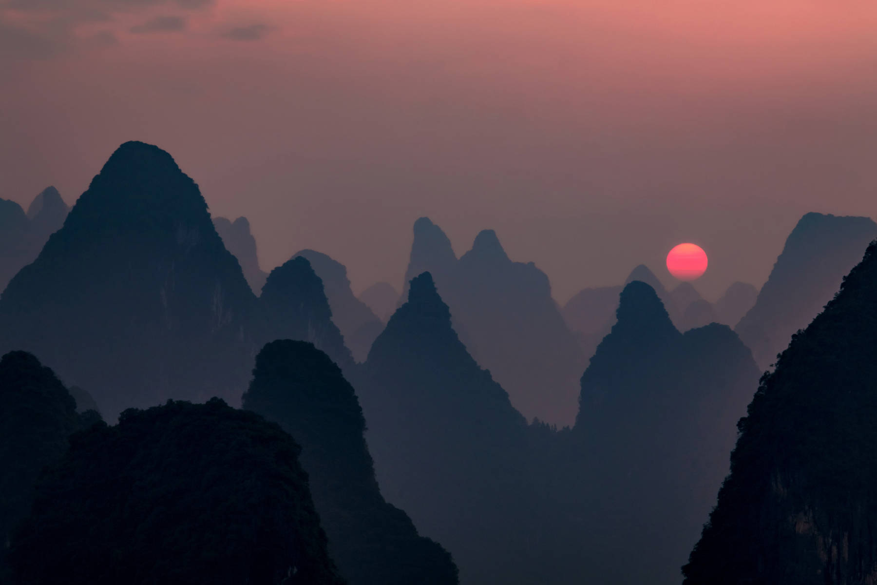
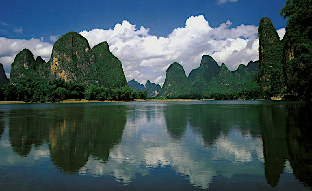
桂林市 (Guilin) in is one of China’s top tourist attractions because of its spectacular tower karst. There are numerous steep karst towers with huge caves inside. Collapsed caves form dolines and natural bridges like the Elephant Trunk Hill. The whole area is crossed by the Lijiang river. The city of Guilin is located in the center of the area. Three important and very popular show caves are located close to the city, Reed Flute Cave, Seven Star Cave and Pierced Hill Cave. Several other caves are located to the south, Crown Cave, Silver Cave, and Rich Fish Cave.
Another center of karst related features and tower karst is in Fengshan County and Bama Yao Autonomous County.
Like pearls on a string the show caves can be found along Cifu River, which flows out of
 Sanmenhai Water Caves,
then it flows on the surface 4 km to Tongshou Mountain.
The underground passage here is about 1 km long, and then it flows on the surface again for more than 1 km.
Then it sinks again and crosses a karst plateau with many karst towers and cones, and reappears 10 km to the south in
Bama Cave
and flows above ground for 750 m, sinks again and returns after 1.5 km underground at
Baimo Cave.
Now it flows on the surface 7 km to
Bainiao Cave
where it is underground for 1 km and for the last time.
Sanmenhai Water Caves,
then it flows on the surface 4 km to Tongshou Mountain.
The underground passage here is about 1 km long, and then it flows on the surface again for more than 1 km.
Then it sinks again and crosses a karst plateau with many karst towers and cones, and reappears 10 km to the south in
Bama Cave
and flows above ground for 750 m, sinks again and returns after 1.5 km underground at
Baimo Cave.
Now it flows on the surface 7 km to
Bainiao Cave
where it is underground for 1 km and for the last time.
Literature
- Huang Chuxing, Franci Gabrovšek, Nadja Zupan Hajna et al (1998): South China Karst 1, ZRC Publishing House, Karst Research Institute, ISBN 961-6182-68-4. online DOI pdf
- Baimo Cave
- Bainiao Cave
- Bama Cave
- Black Buddha Cave
- Butterfly Cave
- Changshou Shuijinggong
 Chuanlong Dong
- Cotton Sinkhole
- Crown Cave
- Dashiwei Tiankeng
- Dragon Cave
- Feng Yu Yan
 Gongmutang
- Huangzhu Dong
- Jiangzhou Natural Bridge
- Jinshuiyan
- Assembly Dragon Cave
- Luomei Lotus Cave
- Longquan Cave
- Longyan Cave
- Xingping Lotus Cave
- Ludi Yan (Reed Flute Cave)
- Lumingsen Valley Tourist Resort
- Luocheng Changsheng Dong
- Moon Hill
- Moon Water Cave
- Leye Piercing Tiankeng
- Qixing Yan Guilin - Seven Star Cave
- Sanmenhai Water Caves
- Shegeng Through Cave
- Tongshou Mountain
- Fairy Bridge
- Yuanyang Cave
- Lipu Silver Cave
- Yunfengdong
 Guangxi - Wikipedia (visited: 24-FEB-2026)
 South China Karst (visited: 24-FEB-2026)
 Index
Index Topics
 Hierarchical
 Countries
 Maps
Maps Search