Riesenburg
Giants Castle
Useful Information
| Location: |
A3 exit Höchstadt-Ost, A9 exit Pegnitz, A73 exit Forchheim-Süd.
On the B470 to Behringersmühle, towards Waischenfeld up the Wisenttal (Wiesent valley).
Parking at the road, signposted.
(49.8033518, 11.2969458) |
| Open: |
no restrictions. [2021] |
| Fee: |
free. [2021] |
| Classification: |
 Karst cave Karst cave
 Collapsed Cave
dolomite Collapsed Cave
dolomite
|
| Light: | not necessary |
| Dimension: | P: L=30 m, B=12 m, H=9 m. |
| Guided tours: | self guided |
| Photography: | allowed |
| Accessibility: | no |
| Bibliography: | |
| Address: |
Touristinformation Muggendorf, Forchheimer Str. 8, 91346 Wiesenttal-Muggendorf, Tel: +49-9196-929931, Fax: +49-9196-929930.
E-mail: |
| As far as we know this information was accurate when it was published (see years in brackets), but may have changed since then. Please check rates and details directly with the companies in question if you need more recent info. |
|
History
| 1793 | visit by the Ansbach chancery inspector and draughtsman Johann Gottfried Köppel. |
| 1798 | visited by the freedom poet and patriot Ernst Moritz Arndt. |
| 1804 | visited by Johann Christian Rosenmüller. |
| 1810 | visit by the naturalist August Goldfuß. |
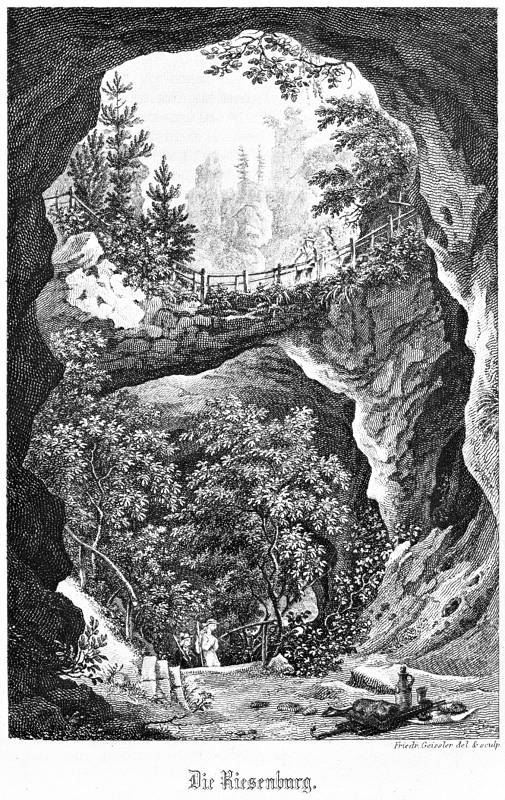
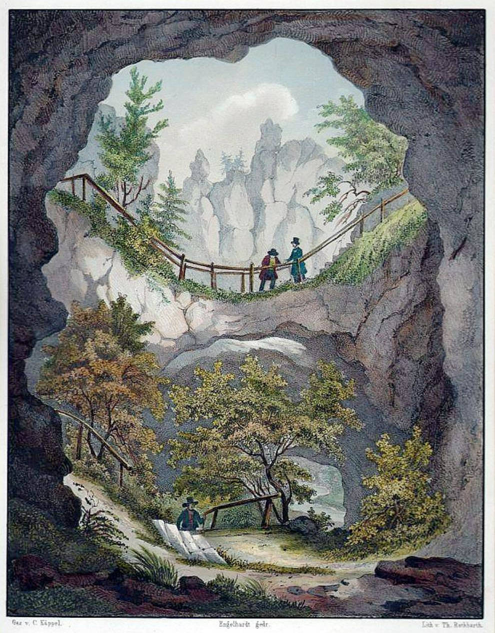
| 1828 | remodelling of the rock labyrinth by building paths and bridges on behalf of Count Erwin von Schönborn. |
| 1829 | visited by the historian Joseph Heller. |
| 1830 | visit by the Bavarian King Ludwig I. and his wife Therese. |
| 1837 | visited by the Dresden painter Ludwig Richter. |
| 1902 | description of the cave by Adalbert Neischel. |
| 1902 | pen drawing by F. Bär. |
| 2007 | Riesenburg officially included in the list of the 100 most important geological natural wonders of Bavaria. |
Description
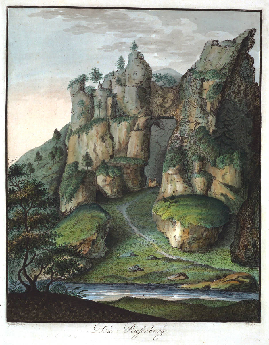
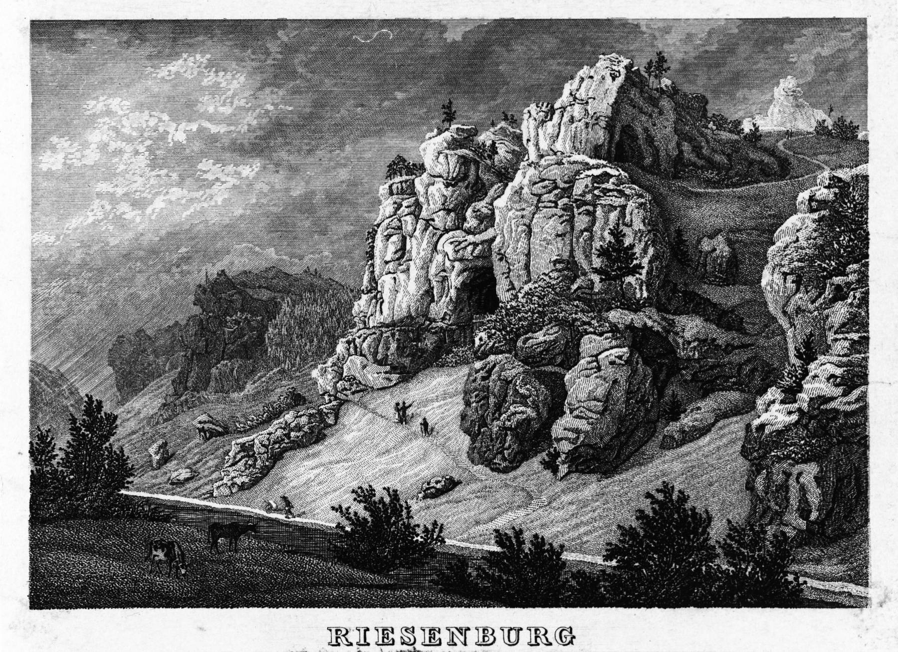
The name of the Giant Castle comes from the giant-like appearance of the rock massif, or also because the rocks are reminiscent of a giant castle ruin.
In the past, however, the cave was called Geisskirche or Geissloch because of the sheep and goats grazing there.
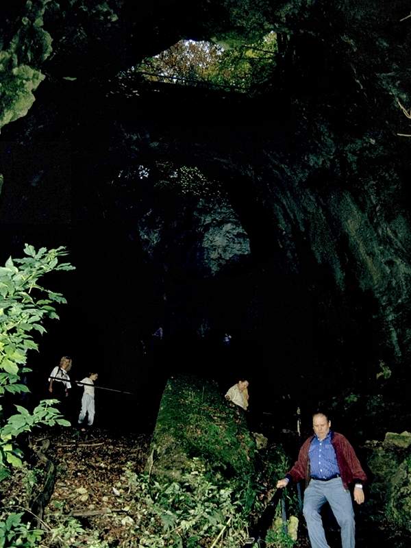
The dolomite stock contained a large cave, but due to progressive weathering the roof has almost completely collapsed and half-caves and natural bridges have formed.
Sometimes the cave was also called
doline
but this is not quite correct.
A collapse doline occurs when a cave ceiling becomes too thin at one point and collapses.
If this process continues until the ceiling has almost completely collapsed, except for a few remnants, it is referred to as a
cave ruin
or also from a
 natural bridge.
The cave room is 43 m long and has a height difference of 25 m over this distance. It has several natural bridges with a span up to 11 m. Due to the large difference in height and the 10 m high vertical walls, the whole thing looks more like a gorge.
At the beginning of the 19th century, the Riesenburg was owned by Count Franz Erwein von Schönborn. He recognised its special features, bought it in 1828 and had paths built. They lead up from the valley in serpentines along the cave floor and over the largest natural bridge to a vantage point. He also had the previously bare slopes reforested to increase the romantic effect of the rocks. After its completion, the Riesenburg became a destination for excursions. Among others, it was visited by King Ludwig I.. This is commemorated by an inscription carved into the rock:
"Following the wind, the clouds come to the rock and recede,
But unchangeable stands the rock in time."
- Ludwig I.
The king was known for forging verses on all occasions. None of the well-known naturalists, writers and artists of the time omitted a visit to the Riesenburg. In rapturous texts, it was described as a "ghastly vault and eerie crypts", a "huge, eerie rock castle" or the "majestic edifice of giants". But that was not all, entire poems were written:


The glow of the summer day
Heavy on the silent narrow valley,
And all seeks the shade of the hat
From the blazing sun's sting and ray.
The mountain's interior opens up.
Where masses of rock stand towering,
And over stone steps up
I climb these cool heights.
Here the spirit of the past blows upon me,
That bears witness to vast thoughts,
But what lies below in the plan
To the dizzy gaze escapes.
Giants once dwelt here,
The rock castle towered up,
Which never roared with the sound of the world,
Which now shields the weary wanderer.
From the many-pronged cleft,
Where the echo thunders
I read secret magic writing,
The showers of ancient fairy-tale splendour.
Two brothers lived together long
Of robbery and murder, they hit well
And made all the region afraid,
For many a man lay in his blood.
What came afar, their eyes spied
From the nearby eagle stone,
That stands tall on the open plain,
And looks far into the land.
From the hiding place's open round
They send the arrow of death;
They spare no one, deep in the ground
Their projectile hinders the wall'rer's haste.
But none dares to disturb the pair of robbers
To disturb in the desolate robbery;
The mountain is not climbable,
They are deaf to all entreaties.
In their caves deep wall
Their greed holds treasures in heaps.
With rocks the giant hand
The opening always closed and open.
But at last, since they have lived for a long time
In their castle united lived,
They are divided over a robbery,
Which each strives to possess.
And since the one once escaped,
The brother wants to shut him out,
Barricades himself all around for protection
With stone and rock the giant house.
Andre comes, rushing wildly up
Cursing loudly, as he above takes
The heaviest stone for a defence,
Hitting the one who climbs swiftly upwards.
He falls. - But his fist
In sudden fall the rocks all,
That on the enemy's head roars
The stones' swift fall.
And both go in one hour
To the death that ends their strife:
The giant's image in the stone makes known
What once happened here.
Still the giant castle stands so bold
And defies the fang of time's destruction,
Which has clothed its grey stone with green
The most beautiful dress has put on.
The finch's merry song resounds
Now in the uninhabited castle,
The dark fir forest
Is filled with a gentle peace.
The cave was formed by the Cretaceous karstification of the Franconian Alb, which was an island in the Upper Cretaceous in a tropical climate. At the end of the karstification, the cave was then almost completely filled with washed-in loamy sediments. The Franconian Alps then subsided again, karstification ended and sediments were again deposited on the Jurassic limestone until the Tertiary. After the last subsidence of the sea, the Wisent, or rather Ur-Wisent, began to cut into the limestone. When it reached the level of the filled cave, it began to flow through the cave and clear it out again. The loose sediments offered much less resistance to erosion than the dolomite. It is assumed that the cave also became a ruin because the cavity filling that had previously stabilised the cave was now missing. A small part of the former cave still exists in the rear part of the Riesenburg.
 Search Google for "Riesenburg"...
 Giant castle (cave) - Wikipedia (visited: 24-MAY-2021)
 Riesenburg Versturzhöhle (visited: 24-MAY-2021)
 Index
Index Topics
 Hierarchical
 Countries
 Maps
Maps Search