Silicka Ladnica Jaskyna
Silicka Ice Cave
Useful Information


| Location: |
Slovensky Kras, between Rožnava and Plesivec.
Slovensky kras, Silicka planina, cadastral area Slavec, district Roznava, Kosicky region.
(48.5494983, 20.5035567) |
| Open: |
Outlook: no restrictions. Cave: after appointment with the Gombasek Show Cave Service. [2025] |
| Fee: |
Outlook: free Cave: fee. [2025] |
| Classification: |
 Karst Cave
ice cave. Karst Cave
ice cave.
|
| Light: | None. For entrance shaft daylight is sufficient. |
| Dimension: | L=8,355 m, A=503 m asl. |
| Guided tours: | L=1,000 m, T=7 °C. |
| Photography: | allowed |
| Accessibility: | no |
| Bibliography: | |
| Address: |
Správa slovenských jaskýň, Hodžova 11, 031 01 Liptovský Mikuláš, Tel: +421-44-553-61-01, Tel: +421-44-553-64-11.
E-mail: |
| As far as we know this information was accurate when it was published (see years in brackets), but may have changed since then. Please check rates and details directly with the companies in question if you need more recent info. |
|
History
| 1744 | first written mention in the description of the Turnian stool. |
| 1719 | painting of the cave by J. Buchholtz. |
| 1931 | cave explored by J. Majko who reached the Archaeological Dome. |
| 1988 | sumps of Čierny potok explored by Czech cave divers. |
Description

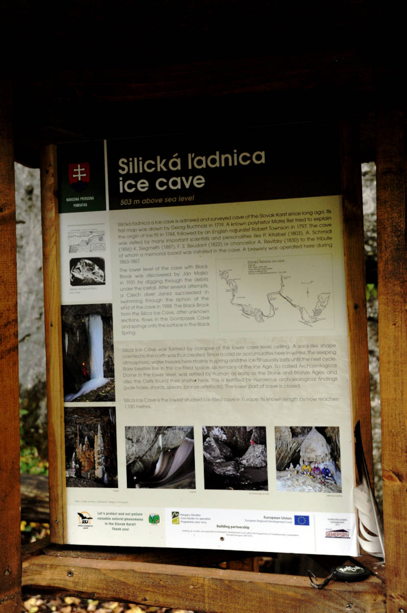
We had several problems, to decide if Jaskyňa Silická ľadnica (Silická Ice Cave) is a show cave or not. On one hand, the cave is very fragile and has very interesting troglobiont biology. On the other hand, the Slovak Cave Administration lists it as a touristic cave, as one of the most important natural sights of the Silická Plateau in the Slovak Karst.
Silicka Ladnica Jaskyna is, as the name says, an
ice cave.
This means, it has a natural opening to the surface, which works as a cold trap.
Cold air is heavier than warm air, and thus "flows" into the cave during winter.
The entrance shaft is 80 m deep and has temperatures slightly below zero.
Dripping water freezes most of the year and typically does not melt completely in the summer.
This entrance shaft may be visited on an outlook terrace with explanatory texts. It is a stop on a touristic route through the area, prepared by the Slovak Cave Administration. The viewpoint offers a good view of the ice formations, which can be seen almost all year round. At the bottom of the shaft the cave gets very narrow, and so the ice shaft and the horizontal cave have little exchange, and the cave behind is called warm. This obviously means, it is not as cold as the ice cave and there is no ice. The temperature is quite typical for the caves of the area around 9 °C.
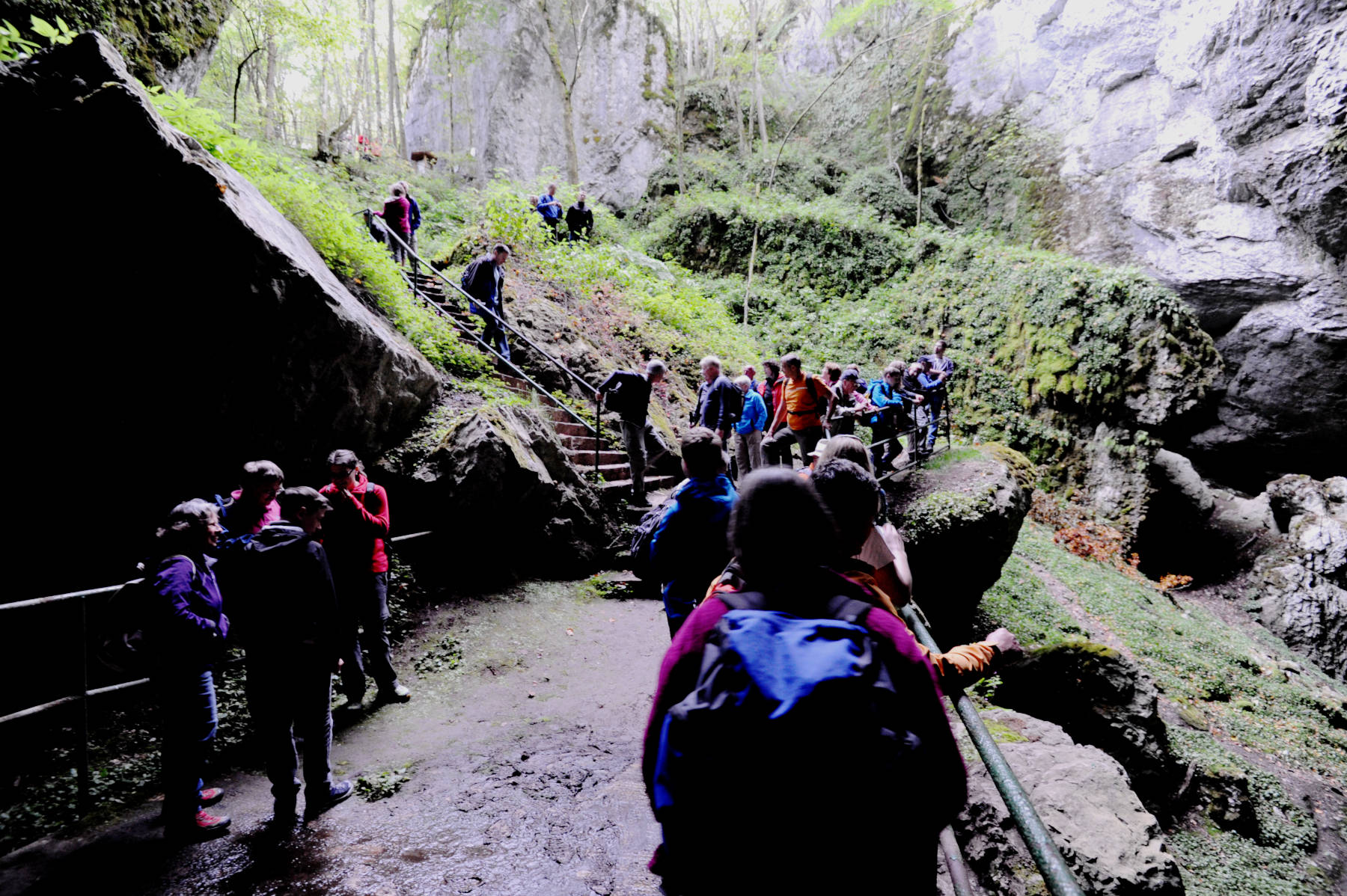
In other words, this cave is visited from the outlook, which is easily accessible with a short hike without any restrictions. But the cave is guided too, but only for small groups of physically fit visitors with an appointment. The entrance shaft is slippery because of the ice, and a descent without the appropriate gear is very dangerous. The cave passage itself is not very difficult. About 1,000 m are visited on those tours. However, you should definitely be aware that these are cave trekking tours requiring the right equipment and physical fitness.
The warm passage is famous for archaeological finds, but as the cave was accessible, the site was vandalized and archaeological remains stolen. Today the cave is protected by a gate at the bottom of the entrance shaft. This also reduces the interchange between cold and warm part. The cave was visited several times. Archaeological remains date back to the Neolithic, La Tène and Bronze Age. Charcoal from hearths indicates a possible Lower Paleolithic settlement.
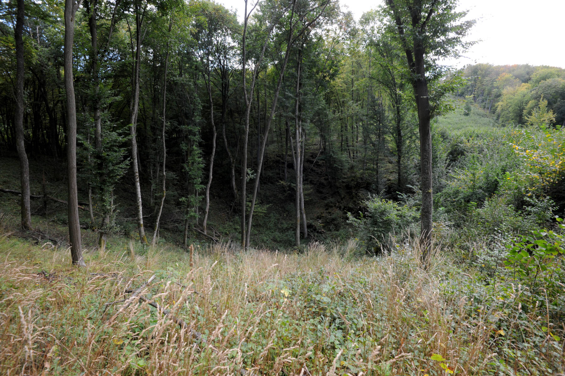
If you visit the cave we strongly recommend walking the karst trail, the cave is only one stop on this trail. There are numerous small caves, for example the nearby Babská diera. There are also dozens of huge dolines, one of them can be seen on the photo left. And quite spectacular is a small polje, which is shown on the panorama below. Quite typical is the absolutely flat floor, which is used for agriculture, and the hills on all sides of the depression. The fact that this is not a valley can easily be seen: there is neither inflow nor outflow of a river.

 Search DuckDuckGo for "Silicka Ladnica Jaskyna"
 Google Earth Placemark
 OpenStreetMap
 Jaskyňa Silická ľadnica (visited: 06-JUL-2025)
 Index
Index Topics
 Hierarchical
 Countries
 Maps
Maps