Tassili n’Ajjer
Useful Information

| Location: |
Southern Algeria.
(26.096411, 8.193547) |
| Open: |
no restrictions. [2021] |
| Fee: |
Fees for tour operators. [2021] |
| Classification: |
 Erosional Cave
sandstone cave Erosional Cave
sandstone cave
|
| Light: | bring torch |
| Dimension: | Ar=72,000 km² |
| Guided tours: | self guided/tour operators |
| Photography: | allowed |
| Accessibility: | no |
| Bibliography: | Alfred Muzzolini (2001): Saharan Africa Handbook of Rock Art Research, David Whitley (ed.). Altamira Press: 605–636. |
| Address: |
Office du Parc national du Tassili (OPNT), BP 11 Djanet, 33100 Algeria, Tel: +213-29-48-32-15.
Direction du Patrimoine Culturel, Ministere de la Culture, Les Anasser-Kouba, Alger. |
| As far as we know this information was accurate when it was published (see years in brackets), but may have changed since then. Please check rates and details directly with the companies in question if you need more recent info. |
|
History
| 1863 | discovery of rock paintings by Europeans. |
| 1892-1921 | survey of paintings by G. B. M. Flamand. |
| 1893-1898 | survey of paintings by A. Pomel. |
| 1901-1927 | survey of paintings by Stéphane Gsell. |
| 1918-1938 | survey of paintings by L. Joleaud. |
| 1925 | survey of paintings by Leo Frobenius and Hugo Obermaier. |
| 1931-1957 | survey of paintings by Abbe Henri Breuil. |
| 1935-1955 | survey of paintings by Raymond Vaufrey. |
| 1972 | designated a Cultural Park by the Ministère de la Culture et des Arts. |
| 1982 | inscribed on the UNESCO World Heritage List. |
| 1986 | designated a UNESCO-MAB Biosphere Reserve. |
Description
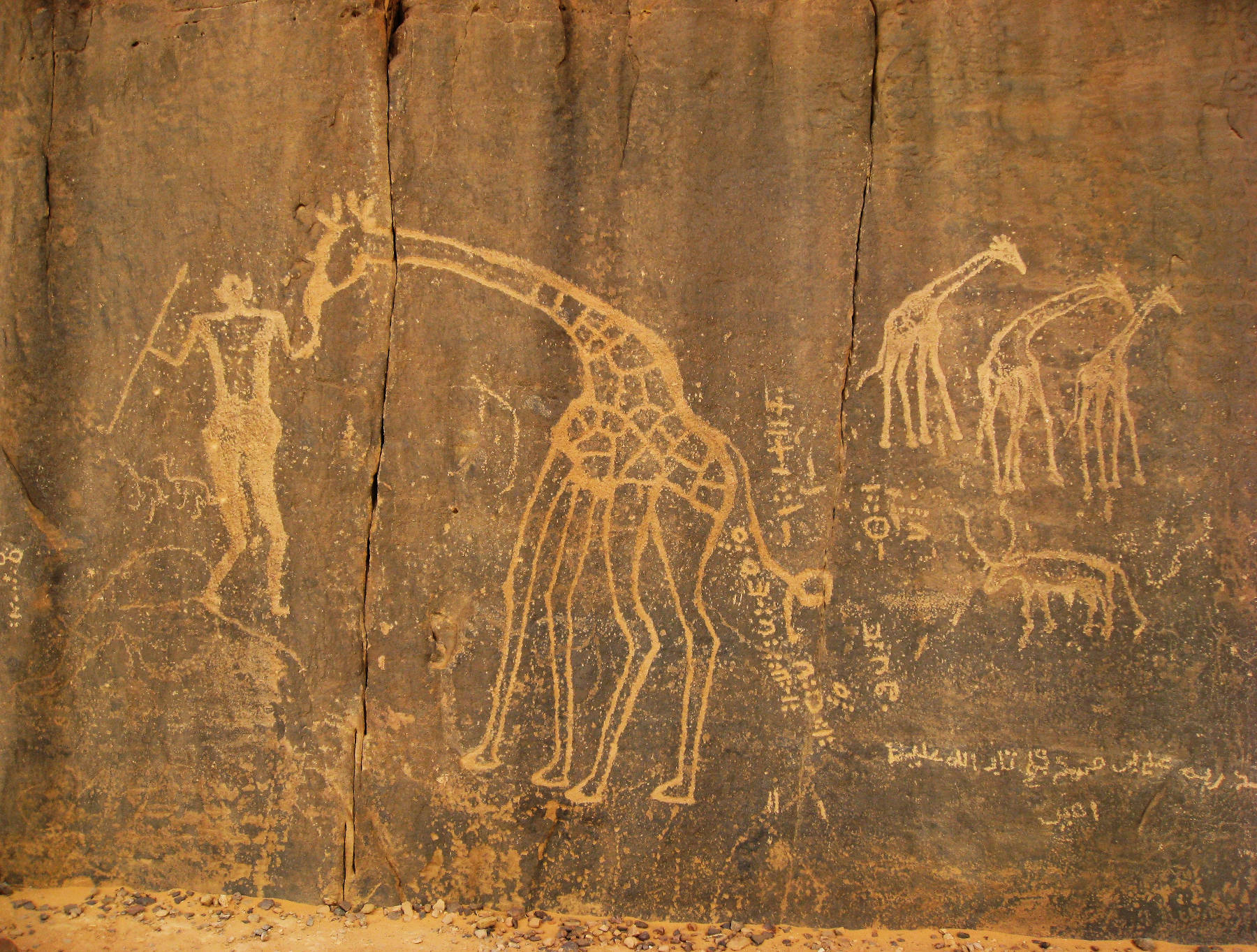
The Tassili n’Ajjer is a mountain range in the Sahara desert in southeast Algeria. It extends about 500 km from 26°20’N 5°00’E east-south-east to 24°00’N 10°00’E. This range is composed of sedimentary rocks, mainly sandstones. Erosion formed arches and overhanging cliffs, rock shelters and small caves. About 300 of this places are known, many of them showing rock art.
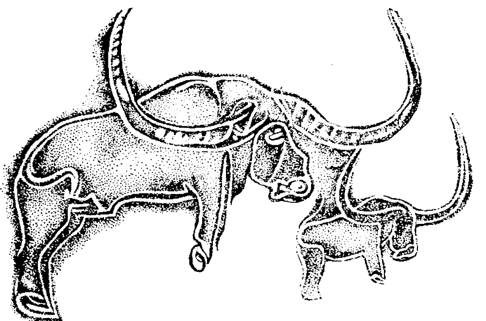
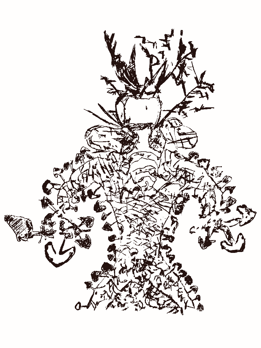
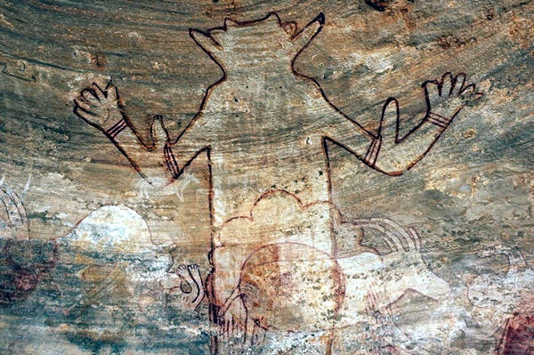
During glacial times the local climate was much moister, the desert was a rather fertile savannah and home to many people. There remains of this people are cave paintings showing typical animals and sometimes even swimming people. The most frequent depicted animals are hippopotamus, buffalo, elephant, rhinoceros and giraffe. Most paintings and engravings are found in Wadi Djerat and on the Plateau of Dider.
The geology of this mountain range is important for the local vegetation. The sandstone is able to store water, and even transport it through its pores by capillary forces. This results in a higher amount of moisture and a different, more abundant vegetation. In the eastern half of the range, in higher parts, a very scattered woodland of Saharan Cypress and Saharan Myrtle exist. This endemic species are endangered and protected in a National Park, Biosphere Reserve and World Heritage Site, the Tassili n’Ajjer National Park.
As we explained there is not a single site and the sites are off road and hard to find. They have reached some fame and the area being protected as National Park, Biosphere Reserve and World Heritage Site also resulted in touristic relevance. The sites are best few on Jeep Safaris, which are organized by various operators. They take several days and differ very much in length, prices and itinerary.
- See also
 Subterranean World Heritage List
 Search DuckDuckGo for "Tassili n’Ajjer"
 Google Earth Placemark
 Tassili n’Ajjer - Wikipedia (visited: 23-FEB-2026)
- Tassili n’Ajjer - UNESCO World Heritage List (visited: 23-FEB-2026)
 Tassili n’Ajjer (visited: 22-FEB-2026)
- The Natural Arches of Tassili National Park (visited: 22-FEB-2026)
- Prehistory of Central North Africa (visited: 22-FEB-2026)
 Index
Index Topics
 Hierarchical
 Countries
 Maps
Maps