Les casemates du Bock
Bock Casemates - Bockkasematten - archaeological Crypt and Casemates
Useful Information
| Location: |
10 Montée de Clausen, 1343 Grund Luxembourg.
Bock, Luxembourg city center. (49.611663, 6.136320) |
| Open: |
APR to 14-NOV daily 10-17. 15-NOV to MAR daily 10:45-15. Closed 15-DEC, 01-JAN. [2023] |
| Fee: |
Adults EUR 8, Children (4-12) EUR 4, Children (0-3) free, Students EUR 6.50, Seniors EUR 6.50. [2023] |
| Classification: |
 Casemates Casemates
|
| Light: |
 Electric Light Electric Light
|
| Dimension: | Ar=1,100 m². Main Casemate: L=110 m, H=7 m. |
| Guided tours: | self-guided, St=391. V=152,000/a [2019] |
| Photography: | allowed |
| Accessibility: | no |
| Bibliography: | |
| Address: |
Les casemates du Bock, 10 Montée de Clausen, 1343 Grund Luxembourg.
Luxembourg City Tourist Office, 30, Place Guillaume II, 1648 Luxembourg, Tel: +352-222809. E-mail: |
| As far as we know this information was accurate when it was published (see years in brackets), but may have changed since then. Please check rates and details directly with the companies in question if you need more recent info. |
|
History
| 963 | purchased by Ardennes count Siegfried. |
| 1644 | first underground tunnels built during the Spanish domination. |
| 1737-1746 | underground works to place 50 canons and a garrison of 1,200 men on the rock. |
| 1781 | visited by Kaiser Josef II of Austia. |
| 1804 | visited by Napoleon I. |
| 1868 | visited by Prince Henry of the Netherlands. |
| 1875 | all buildings destroyed except for one tower. |
| 1933 | opened to the public. |
| 1936 | visited by Grand Duchess Charlotte. |
| 1992/93 | Castle Bridge restored. |
| 1993 | during excavations, the remains of the first château comtal, or count’s castle, erected by the city’s founder, Count Sigfried were found. |
| 1994 | inscribed on the UNESCO World Heritage List. |
| 2000 | visited by Grand Duke Henri and Grand Duchess Maria Teresa. |
| 2008-2009 | renovated, new light system. |
Description

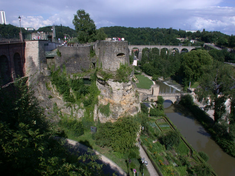
The Bock is a sort of rock protrusion, the meander spur of a meander of the river Alzette. Formed by the erosional forces of the river, it was cut out of the Jurassic Sandstone which forms the plateau. Surrounded by the river valley on three sides, it is connected to the plateau on the fourth side to the west. This geographic situation is commonly used to build castles, as the three sides are easy to defend, and the fourth side is needed to enter the castle. This side is fortified by a thick wall and a moat.
The Bock Promontory was purchased in 963 by Siegfried, Count of Ardenne, from the Saint Maximin Abbey in Trier, who owned this land. He created the first fortification, which proved easy to defend and played a strategically crucial role. So Count Sigfried is actually the city’s founder.
Melusina was the wife of Sigfried, 1st count of Luxembourg, living in his castle on the rocky Bock promontory. On their marriage, Melusina required her husband never to see her during a particular day and night of the week. One fine day, unable to resist his curiosity, Sigfried spied her in her bath through the keyhole of her room’s door and discovered her fish’s tail. Melusina, noting that her husband was watching her, then vanished forever into the torrents of the Alzette river.
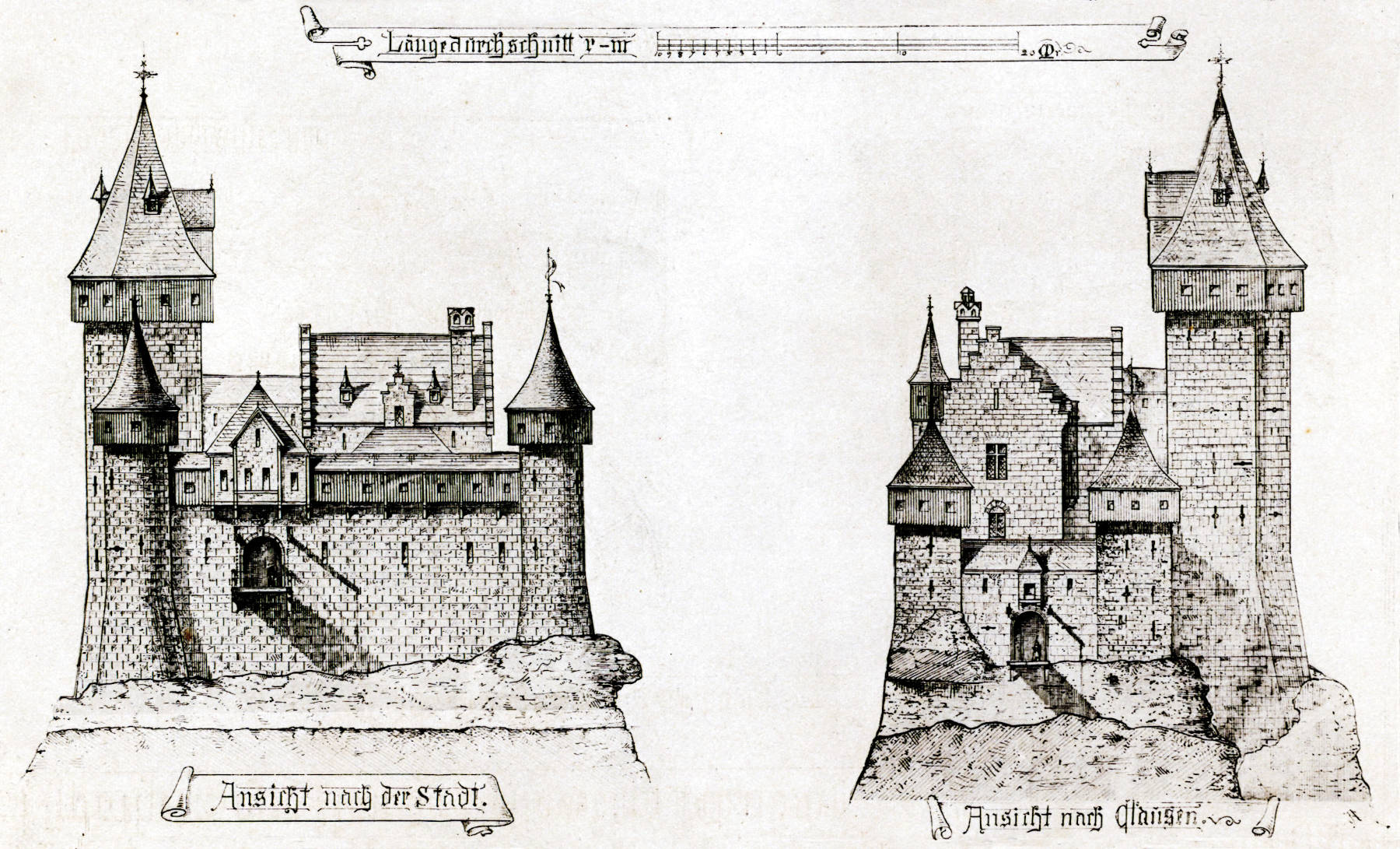
It remained a typical Medieval castle until the 18th century, when the Austrians converted it into an extraordinary fortification. From 1737 to 1746 underground works were carried out, to place 50 canons and a garrison of 1,200 men on the rock. When the whole fortification was destroyed in 1875, the underground remained almost untouched.
Today the casemates may be visited again, the entrance is located on the road Montée de Clausen, which runs down the Bock from the city center to the river Alzette. It is reached from the city by walking down Rue Sigefroi, which is also N1 at this place. A stair leads down to the entrance and ticket office.
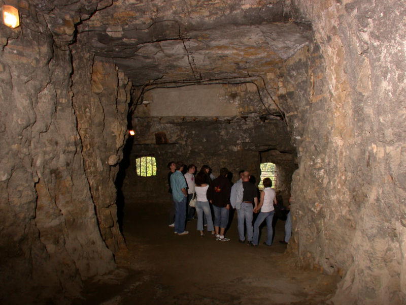
First, the Archaeological Crypt is entered. During excavations in 1993 the vestiges of the first château comtal, or count’s castle, were discovered. A huge cavern is formed by the modern road above, which is built on a concrete bridge. Modern technology is used to preserve and protect the castle structures of the first Dukes of Luxembourg. Several plates explain the history of the city fortifications.
The next stop is the dungeon of the old Luxembourg castle below. It has openings which were closed by walls. They were used to bring the canons into the structure by pulling them up with winches. The spiral staircases are too narrow for the guns.
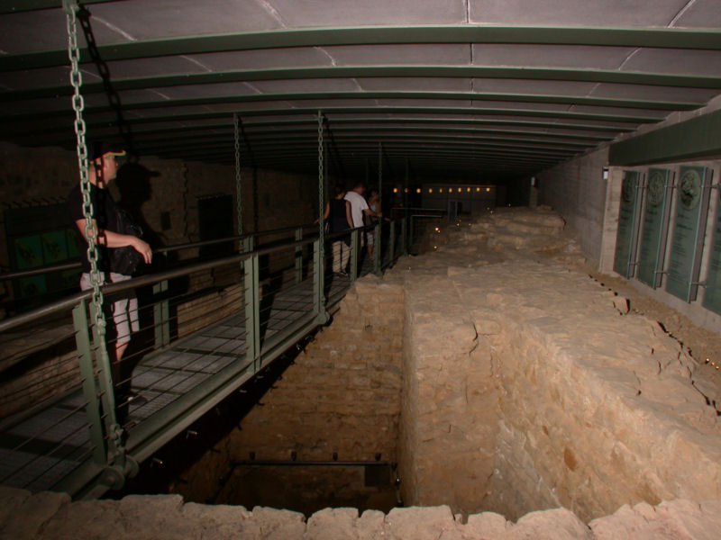
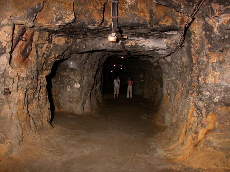
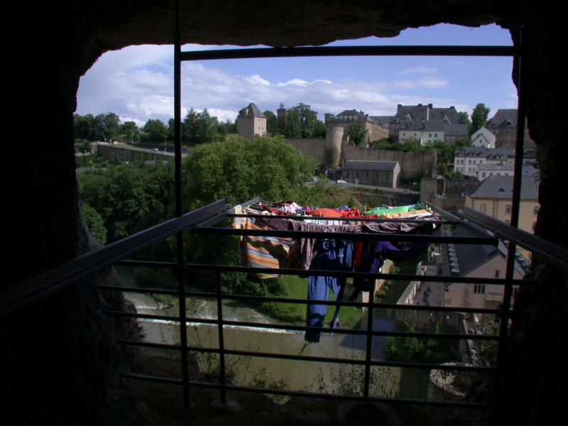
Another staircase leads down into the actual casemates or the main gallery. A long tunnel runs straight down the rock, deep below the surface and parallel to the road above. Numerous side passages brach off, sometimes wide chambers, sometimes passages, often balconies which provide a view into the Alzette valley, both to the south and the north. The balconies were once used to install canons. One of those historic cannons is still on display, the other chambers are either empty or used for art exhibitions.
At the end of the main passage, visitors have to turn around and return to the upper end. From here it’s possible to cross the Castle Bridge, which was formerly not accessible, and leave the site uphill.
Originally the castle had a wooden drawbridge which spanned a wide moat. The Pont du château, Schlossbrücke , or in Letzebürgsch Schlassbréck (Castle Bridge) was built out of red sandstone in 1735 by the Austrians to connect the Upper Town and the Bock Promontory. Its peculiarity is actually that there are multiple connections on different levels. The uppermost level is obvious, it is the road. The lower level connects the casemats on both sides underground, and is the main exit now. But there is a third connection, which is deep below, where the city and the Bock are connected below the former moat and the Rue Sosthène Weis which is today reserved for bicycles and pedestrians. Narrow spiral staircases lead down to this tunnel on both sides. From the city side, it is also possible to enter the interior of the lower arch. This detour is optional and requires good walking shoes and a little physical fitness. In total, the bridge offers a connection on five levels.
- See also
 Subterranean World Heritage List
 Search DuckDuckGo for "Bock Casemats"
 Google Earth Placemark
 OpenStreetMap
 Bock (Luxembourg) - Wikipedia (visited: 05-NOV-2023)
 Bock Promontory, official website (visited: 05-NOV-2023)
- Bock Casemates, Rock with a view (visited: 05-NOV-2023)
- UNESCO World Heritage (visited: 05-NOV-2023)
- City of Luxembourg: its Old Quarters and Fortifications
 Index
Index Topics
 Hierarchical
 Countries
 Maps
Maps