Pertes de la Valserine
Useful Information
| Location: |
Rte de Lyon, D1084, 01200 Valserhône.
Bellegarde sur Valserine. A40 exit Bellegarde, follow RN84 towards Nantua, park on the car park at the foot of the rail viaduct. 30 minutes walk. (46.123166, 5.820875) |
| Open: |
No restrictions. JUL, AUG French-speaking guide available. [2023] |
| Fee: |
free. [2023] |
| Classification: |
 Ponor Ponor
|
| Light: | not necessary. |
| Dimension: | |
| Guided tours: | self guided |
| Photography: | allowed |
| Accessibility: | no |
| Bibliography: |
Eugène Renevier, François Jules Pictet de la Rive (1854):
Fossiles du terrain aptien de la Perte-du-Rhône
|
| Address: |
The Tourist Office, Bellegarde-sur-Valserine, Tel: +33-4504868.
E-mail: |
| As far as we know this information was accurate when it was published (see years in brackets), but may have changed since then. Please check rates and details directly with the companies in question if you need more recent info. |
|
History
Description
The Pertes de la Valserine (Losses of Valserine) are a series of ponors or swallow holes where the river vanishes completely into a cave. The sinking river is located at the lower end of a 300 m long narrow gorge, the reason why this place is also called Gorges de la Valserine (Gorges of the Valserine). Once the gorge was covered by a natural bridge named Pont des Oulles (Bridge of the Potholes), a 300 m long cave where the water was flowing underground. This place was used by travellers and merchants to cross the river. Its importance was the location close to the border between France and Switzerland, and it was the only bridge in the area. So it was also popular with smugglers. In the early 20th century a border post was erected here, although it is actually more than a kilometer from the border. Today some concrete slabs allow walkers to cross the river.
The Valserine river is a tributary to the Rhone, which has its spring at the Col de la Faucille, at the border between the Ain and the Jura. It is 48 km long from the spring to its discharge into the Rhone at Bellegarde-sur-Valserine. It has several tributaries, the biggest one is called Semide and has even a higher yield than the Valserine. The flow of the river depends very much on the season, during May the flow is about 29 m³/s, in October only 8 m³/s. During a flood in January 1982 a flow of 262 m³/s was recorded.
The gorge was cut into the limestone since the glaciers on top of the Jura were melting about 15.000 years ago.
At this time the coldest part of the Würm Ice Age ended and some "lowland" glaciers started to melt.
So the gorge with its impressive
 potholes
is a rather young geologic sight.
potholes
is a rather young geologic sight.
Bellegarde was the first city in France with electric light. Not far from the ponors, the first hydroelectric power plant of France was built at the river. Today only the walls remain of the impressive building.
There is a fine trail on bridges along the river, which allows a good view into the gorge and the sink. The visit is free and there are no restrictions, but obviously it has no sense to visit at night or bad weather. Also, the visit includes some hiking and appropriate shoes are recommended.
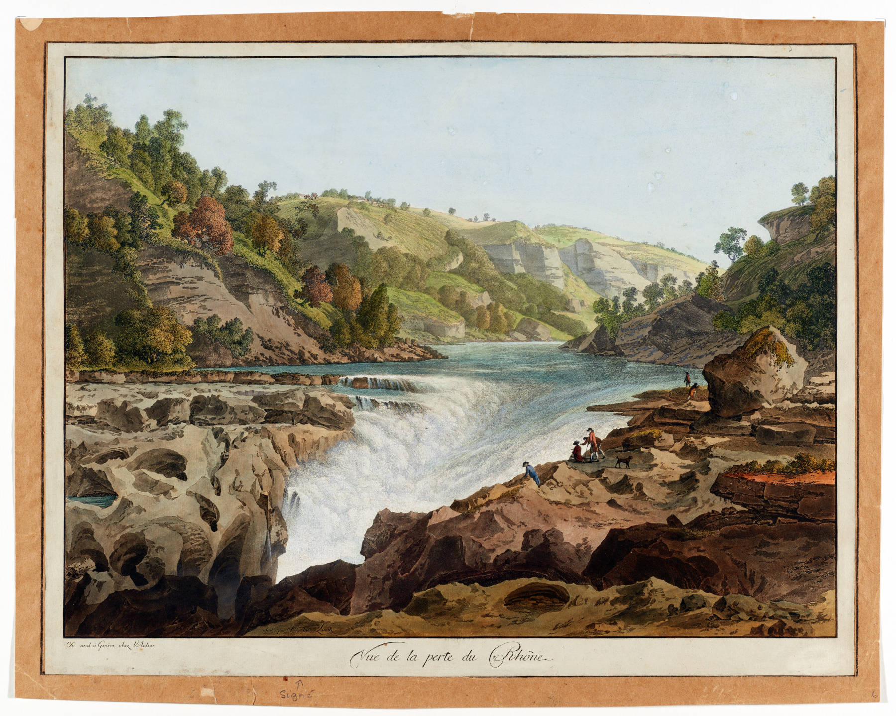
The geologic situation in this area, with karstified limestone crossed by big rivers, caused another similar site called Perte du Rhône (Loss of the Rhone). In this case the Rhone went underground for a length of about 60 m. This place is now destroyed, after the Génissiat Dam was built in 1948 by the architects Albert Laprade and Léon Bazin south of Bellegard. Today the river Rhone forms a 23 km long lake, between the dam and the Swiss border, which covers the ponors completely.
- See also
 Search DuckDuckGo for "Pertes de la Valserine"
 Google Earth Placemark
 Perte du Rhône - Wikipedia (visited: 10-SEP-2014)
- Valserine - Wikipedia (visited: 10-SEP-2014)
 Gorges de Les Pertes de la Valserine (Bellegarde L’Ain ) - Randonnée Haute-Savoie Le blog de l’ Ange de la Yaute
  (visited: 10-SEP-2014)
- Les Pertes de la Valserine, balade visite près de Bellegarde-sur-Valserine dans le département de l’Ain (visited: 10-SEP-2014) extensive gallery. ()
- Les pertes de la Valserine (visited: 10-SEP-2014)
- Réouverture du site des pertes de la Valserine - France 3 Rhône-Alpes (visited: 10-SEP-2014)
- Circuit des gorges de la Valserine (visited: 10-SEP-2014)
 Index
Index Topics
 Hierarchical
 Countries
 Maps
Maps