Grotte de Montgaudier
Useful Information
| Location: | West of Montbron, follow D108 or D699 to Vouthon for 1.5 km. The cave is located below castle Montgaudier. |
| Open: |
Not accessible. [2014] |
| Fee: |
free. [2014] |
| Classification: |
 Karst Cave Karst Cave
|
| Light: | bring torch |
| Dimension: | A=107 m asl. |
| Guided tours: | |
| Photography: | |
| Accessibility: | |
| Bibliography: |
Albert de Nadaillac (1887):
La grotte de Montgaudier (Charente),
Comptes rendus des séances de l’Académie des Inscriptions et Belles-Lettres, 31e année, N. 1, 1887. pp. 42-49.
|
| Address: | |
| As far as we know this information was accurate when it was published (see years in brackets), but may have changed since then. Please check rates and details directly with the companies in question if you need more recent info. |
|
History
| 1886 | archaeologic excavation. |
Description
The Grotte de Montgaudier is named after the castle, where it is located. The main entrance to the huge cave chamber is a portal opening to the valley. The cave has almost the same level as the valley floor, so it is subject to floods.
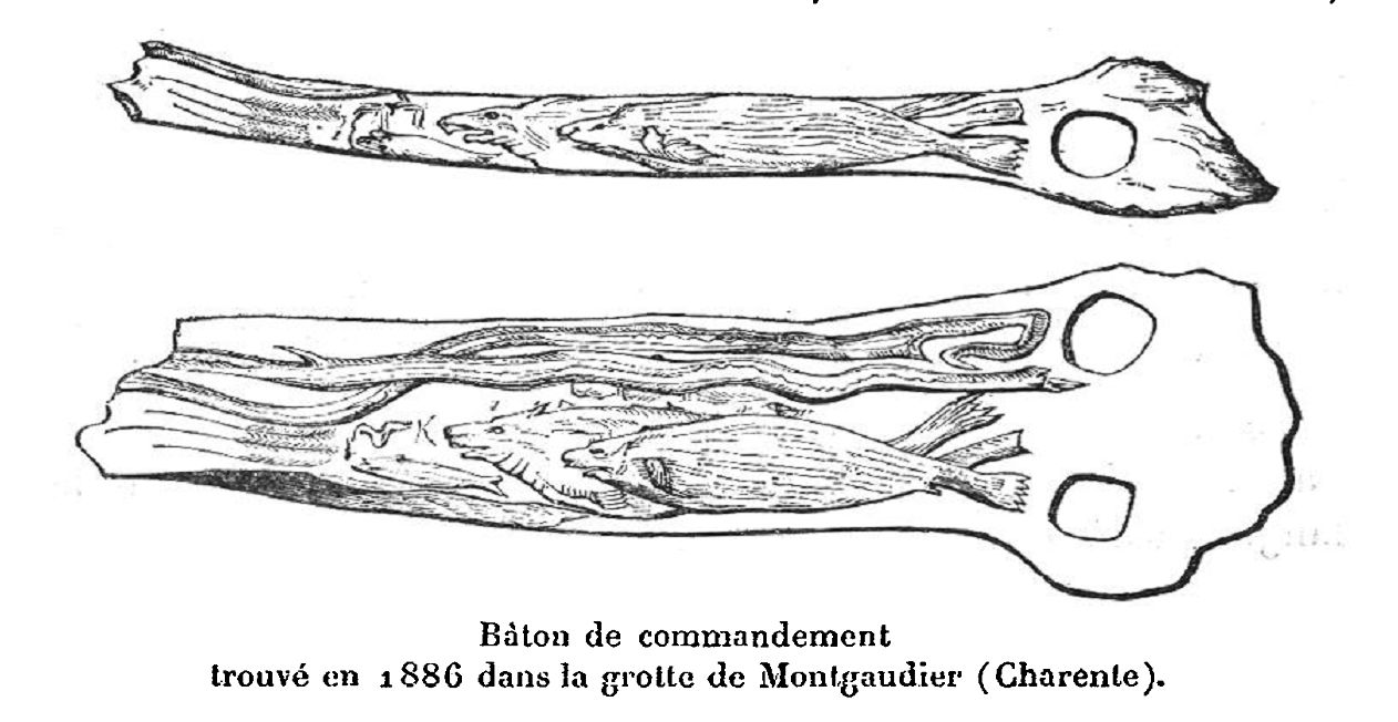
This cave was used as a hunting station between 400.000 and 9.000 years BC. The hunters left the debris of daily life, but sometimes more exceptional things got lost in the cave. One of the most important discoveries in this cave were the bâtons de commandement (commanding sticks), which are simply ivory or bone sticks with elaborate engarvings. Other findings are flint, harpoons, spears, bearded needles, engraved plates, pierced wood and reindeer horns.
It is possible to visit the site, but the cave itself is gated with an iron bar gate.
 Search DuckDuckGo for "Grotte de Montgaudier"
 Google Earth Placemark
 Grotte de Montgaudier - Wikipédia
  (visited: 12-SEP-2014)
 Grotte de Montgaudier Cave or Rock Shelter : The Megalithic Portal and Megalith Map: (visited: 12-SEP-2014)
 Index
Index Topics
 Hierarchical
 Countries
 Maps
Maps