Rhumequelle
Rhume Spring
| Location: |
37434 Rhumspringe.
A7 exit Seesen (Harz), B243 30 km to Herzberg, road to Rhumespringe 9 km. (51.590927, 10.310250) |
| Open: |
no restrictions. [2023] |
| Fee: |
free. [2023] |
| Classification: |
 Karst spring Karst spring
|
| Light: | n/a |
| Dimension: |
Main spring: D=20 m, 360 springs. Yield: average=2,500 l/s, min=900 l/s, max=5,500 m/s. T=8-9 °C. |
| Guided tours: | after prior appointment, organized by Gemeinde Rhumspringe. |
| Photography: | allowed |
| Accessibility: | yes |
| Bibliography: |
Priv. Doz. Axel Herrmann (1969):
Die geologische und hydrologische Situation der Rhumequelle am Südharz,
Abh. Karst- und Höhlenkde, Reihe B, Heft 1, München, 1969
 online
Dr. Stefan Büchner (1998): Neugestaltung der Rhumequelle und ihrer unmittelbaren Umgebung unter Berücksichtigung naturschutzfachlicher und touristischer Aspekte - ein Projekt der Heinz Sielmann Stiftung, 2. Südharz-Symposium 11.-13. September 1998 in Walkenried.
online
Hartmut Lebküchner, Heinz-Gerhard Röhling (): Rhumequelle, größte Karstquelle in Niedersachsen, Landesamt für Bergbau, Energie und Geologie.
pdf
|
| Address: | Gemeinde Rhumspringe, Mühlenbrücke 1, 37434 Rhumspringe, Tel: +49-5529-402. |
| As far as we know this information was accurate when it was published (see years in brackets), but may have changed since then. Please check rates and details directly with the companies in question if you need more recent info. |
|
Description
The Rhumequelle is part of the anhydrite karst area of the southern Harz. The general structure is a slightly falling layer of anhydrite from the Zechstein period. Around the Rhume spring, the anhydrite is covered by water-resistant sandstone layers, only around the spring this cover has a window. And so the water which seeps into the rock, reappears here in a huge spring.
This geologic structure is very common, and it is very important for arid areas. Many oasis’s in northern Africa or at the Dead Sea are based on a similar geologic situation. If the water enters the permeable layer much higher than the spring, it may even reappear with a high pressure, which is then called an artesian spring. The height difference is not that high at the Rhume spring, and the cracks in the rock are obviously rather spacious, so the water leaves the spring in a calm but mighty stream.
The two rivers Oder and Sieber, coming down from the Harz mountains, are only 6 km respective 9 km away. They are connected directly with the spring. High or low water in the rivers immediately results in high or low water in the spring. The swallow holes in the rivers are about 50 m to 60 m higher than the level of the spring. A chain of dolines or sinkholes marks the path of the water from the swallow holes to the spring. A dye tracing experiment proved the connection to the river Sieber and determined the necessary time. The water needed four days to reach the spring.
But the spring is not only fed by the two rivers. It has a catchment area of estimated 350 km². This leads to a very constant temperature of the water at 8-9 °C. The spring never freezes and never dries out, even if the two rivers Oder and Sieber are waterless. In those low water times the rivers loose completely at their respective swallow holes.
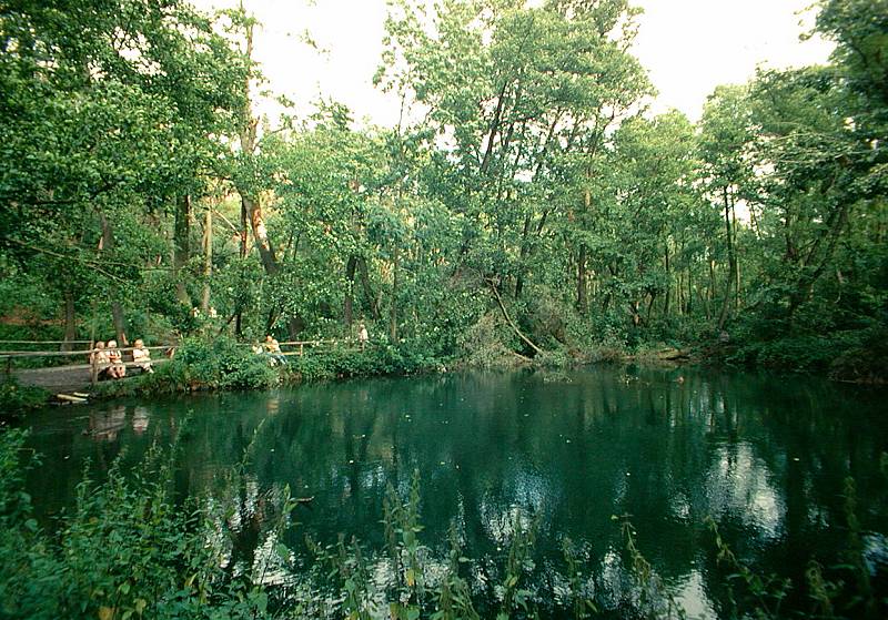
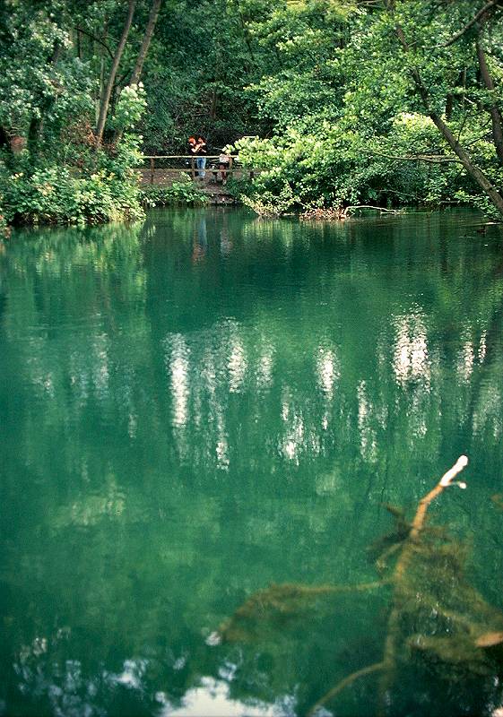
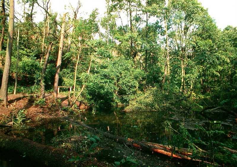
The Rhume spring has a main spying which is about 20 m in diameter and shaped like a funnel. Around it about 360 small springs have been counted. The water in those other springs has a different amount of dissolved limestone and gypsum. This tells us, that they are fed by different caves from different parts of the catchment area. The whole spring has several small lakes which are connected and the river Rhume leaving at the south.
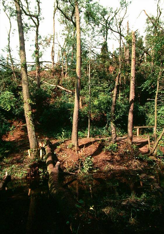
The area of the spring is developed for visitors for centuries, there are public footpaths and bridges, allowing the visitors to walk around the spring. The place is one station of the Karstwanderweg. Back in 1997 it was not possible to walk around the spring for some months, at this time a blizzard felled the trees around the spring. Some big trees were thrown into the water of the spring. But the aftermath of the storm are cleaned up now.
How the Rhumequelle was formed
A young giant called Romar, who lived at the castle on the Römerstein, met once a young and beautiful girl in the forest, and they fell in love with each other. The girl was named Ruma, and she was the daughter of the dwarf king. Unfortunately the fathers were enemies, and so the two married in secret. After some time Ruma became pregnant and gave birth to a small boy.
When the dwarf king found out, who the father of the child was, he punished her and told her to leave Romar. But as she refused steadfast, he cursed, murdered the child and imprisoned her in a cave.
But Ruma tried hard to escape and find Romar. Her mother was a mermaid, and so she searched the narrow and winding subterranean passages by transforming into a stream of water. She tried hard for many years, until she finally reached the surface at the Rothenberg, outside the realm of the dwarfs. This place was called Ruma (Rhume spring). Here Romar and Ruma (Römerstein and Rhume spring) still meet today.
| Bunter (Mittlerer Buntsandstein) | ||
| Obere rotweiße Wechselfolge (su4) | 100-200m | |
| Obere Kalksandsteinzone (su3) | Oberer Teil (su3b) | ca. 20m |
| Unterer Teil (su3a) | ca. 20m | |
| Untere rotweiße Wechselfolge (su2) | Hellrote Folge (su2c) | 30-40m |
| Dunkelrote Folge (su2b) | ca. 30m | |
| Braunrote Folge (su2a) | 50-60m | |
| Untere Kalksandsteinzone (su1b) | 15-20m | |
| Bröckelschiefer (su1a) | ca. 25m | |
| Permian Anhydrite (Zechstein) | ||
| Table: geologic structure of the Rhume spring. | ||
|---|---|---|
- See also
 Search DuckDuckGo for "Rhumequelle"
 Google Earth Placemark
 Rhume Spring - Wikipedia (visited: 22-FEB-2026)
 Die Rhumequelle (visited: 22-FEB-2026)
- Rhumequelle (visited: 22-FEB-2026)
- MC Rhume-Ratten Rhumspringe (visited: 22-FEB-2026)
 Index
Index Topics
 Hierarchical
 Countries
 Maps
Maps