Adršpašsko-teplické skály
Adršpach-Teplice Rocks - Adersbach-Weckelsdorfer Felsenstadt - Adršpašské skály
Useful Information
| Location: |
Adršpach valley, northwest of Teplice.
South of the town Dolní Adršpach.
(50.615173, 16.122832) |
| Open: |
NOV to MAR daily 8-16. APR to OCT daily 8-18. Closed 24-DEC. [2020] |
| Fee: |
Car CZK 50, Motorcycle CZK 50, Bus CZK 100, Camper CZK 100. NOV to MAR: Adults CZK 80, Children (6-15) CZK 40, Children (0-5) free, Students (-26) CZK 40, Seniors (65+) CZK 40. APR to OCT: Adults CZK 120, Children (6-15) CZK 70, Children (0-5) free, Students (-26) CZK 70, Seniors (65+) CZK 70. [2020] |
| Classification: |
 Gorge Gorge
 Talus Cave
Fracture Cave Talus Cave
Fracture Cave
|
| Light: | n/a |
| Dimension: | Ar=17 km² |
| Guided tours: | self guided, L=7 km, D=3 h. |
| Photography: | allowed. drones forbidden. |
| Accessibility: | no |
| Bibliography: | |
| Address: |
Skály Adršpach, Adršpach č.p.26, 54957 Teplice nad Metují, Tel: +420-491-586-012.
E-mail: |
| As far as we know this information was accurate when it was published (see years in brackets), but may have changed since then. Please check rates and details directly with the companies in question if you need more recent info. |
|
History
| 1846 | Skalní chrám opened to the public. |
| 1933 | protected as a national nature reserve. |
| 1958 | Skalní chrám tours discontinued. |
| 1961 | section of Poseidon cave explored by climbers Z. Malínský and P. Švorčík. |
| 1991 | the whole region of Broumovsko declared a protected landscape area. |
| 2006 | rediscovery of Poseidon cave by Roman Mlejnek from the Cave Administration of the Czech Republic. |
Description
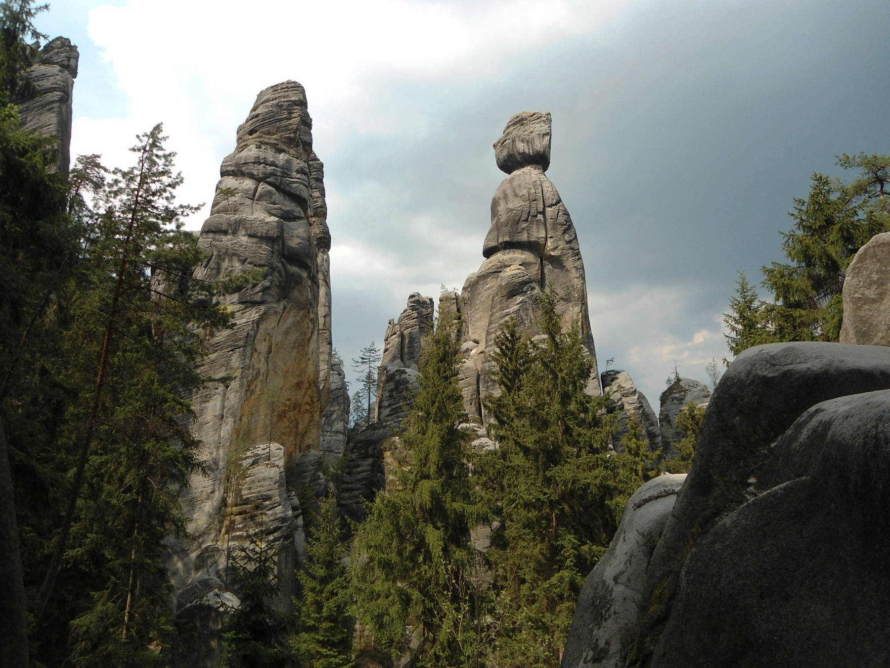
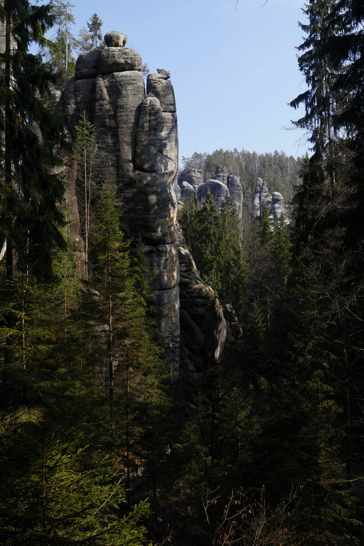
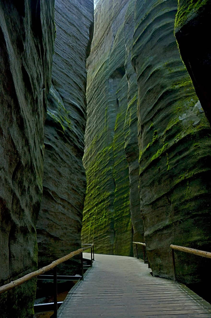
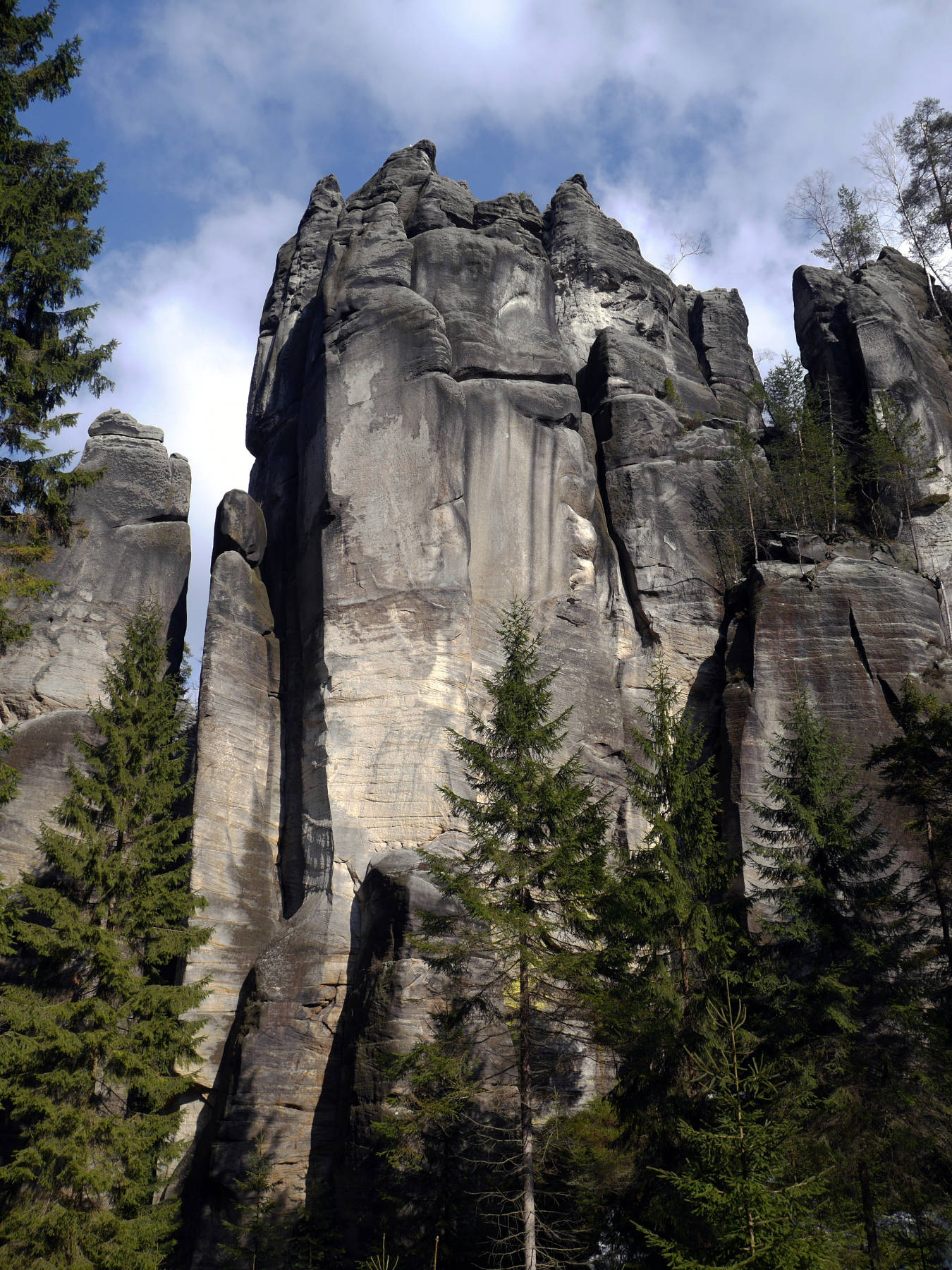
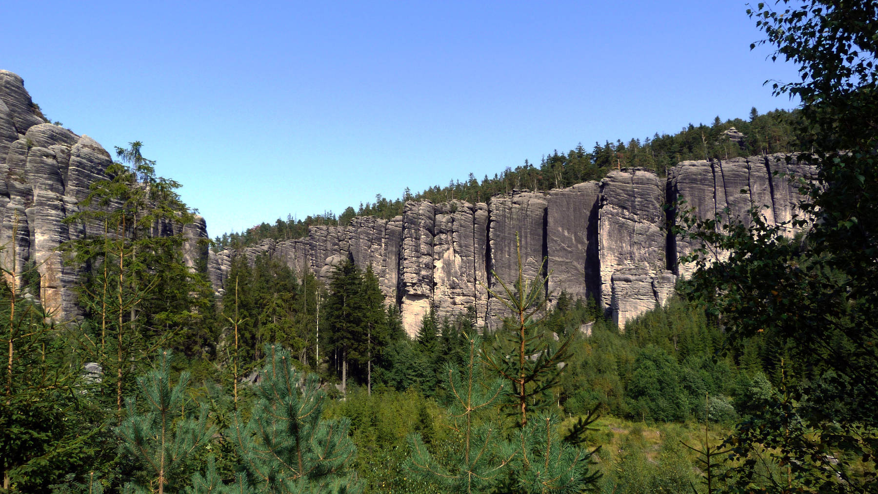
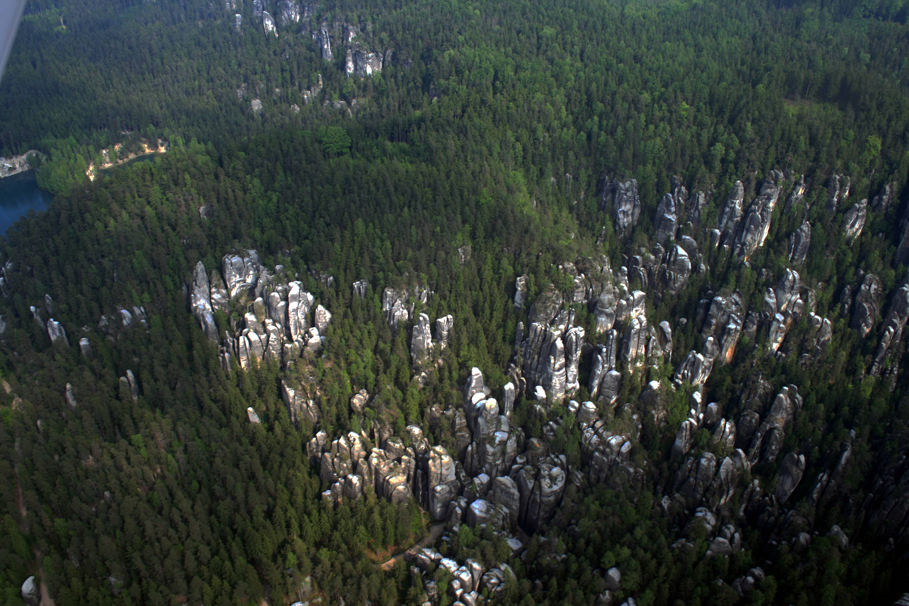
Adršpašsko-teplické skály is an area of reddish sandstone which was cut into blocks by weathering. Water following cracks in the rock widened the cracks and separated the block from each other, creating a labyrinth of narrow gorges. As the cracks originally had two different, almost perpendicular, directions, the gorges now also follow those two main directions.
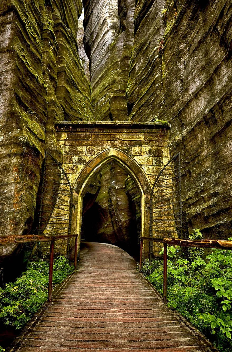
The rocks cover an area of 17 km² in northeastern Bohemia, between the municipalities Adršpach and Teplice nad Metují, hence the name. The area became a popular sightseeing destination in the 19th century, at least of regional fame. The most spectacular gorges were developed by marked trails. Quite impressive is the gate into the labyrinth, with its neo-gothic vault.
While visitors of the 19th century were walking through the rocks, reading poems, drinking laudanum, and scratching their names into the walls, modern visitors tend to get more physical. The rocks are a popular climbing destination, and also used for a pretty dangerous extreme sports called rock jumping. As the name says the idea is to jump from rock to rock, from one pinnacle to the next. Jumps are classified by difficulty, which means distance, but also the general situation. A Grade 1 jump is an easy crossover from one tower to the next. Grade 4 means the jump does not offer a flat landing surface. This forces the jumper to clutch the crevices of the opposite wall. The adrenaline producing aspect is obviously that they do this without security line on 20 m high rock towers.
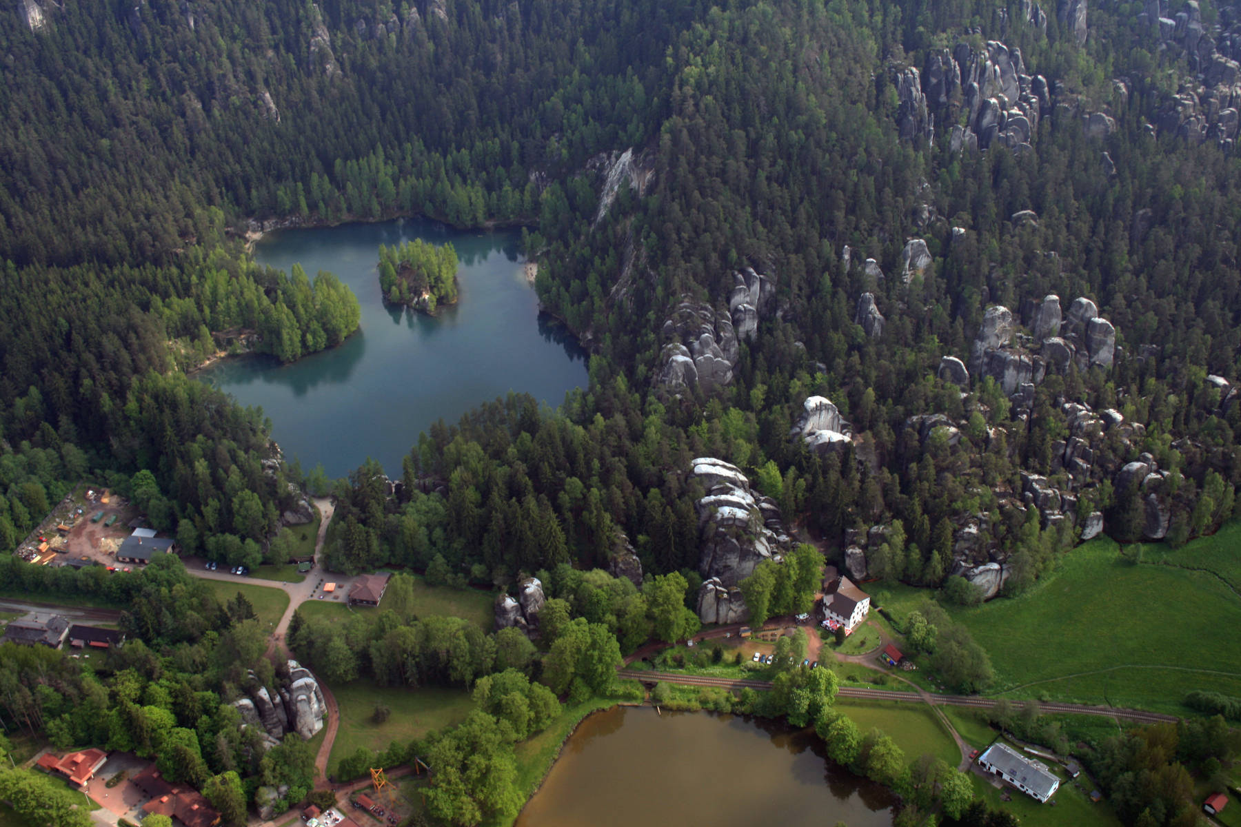
Normal visitors start at the train station Adršpach in the Adršpach valley. Here, beneath the Hotel Skalní město is the main parking lot and the tourist information. The park offers numerous trails, but the main trail is a 7 km round trip which starts here. It shows the most spectacular gorges, caves, natural bridges and outlooks of the park. The trail takes about three hours, including enough time for watching birds and taking pictures. If this is too strenuous, there is also a short tour of 1.5 km around the lake.
The park is not only a geologic sight, it is also famous for its falcons. It is the largest breeding site of falcons in Europe. As a result there are numerous restrictions fot the park, which include climbing restrictions during breeding time and drones are prohibited.
Starozámecký Vrch (Old Castle Hill, 681 m asl.) is located at the western end of the sandstone rocks. On top of the hill is the Adršpach Castle (Burg Adersbach) and it offers a great view on the rock formations. The best way to get there is to turn off the main road at Dolní Adršpach, at the restaurant U Tošováka, and cross the railroad tracks, then turn right. After 300 m the trail to the hill starts.
The Křížová cesta (Way of the Cross) is located north of the hamlet Dolní Adršpach. The Křížová cesta is a separate and much smaller hill with sandstone formations. Starting point for the trail is also the main parking lot beneath the Hotel Skalní město, but you walk to the north. Here is also a trail which takes about three hours and crosses the most impressive rock formations.
Teplické skály (Teplice Rocks) is the southern end of the main hill. Follow the road to Adršpach from Teplice for one kilometer. There is a small hamlet with Hotel Orlík and Penzion Severka and a huge parking lot. From here a 7 km long trail to the Teplice Rocks starts. There are even some water-filled gorges with a brook and waterfalls. At the farthest point is the Echo, the rock walls of Křížový Peak rebound sound seven times. In the 18th century the locals fired off guns for tourists to demonstrate this. The tour will take about 3.5 hours including enough time for taking pictures.
The most extraordinary cave of the Czech Republic is located here, named Poseidon. Parallel gorges in the sandstone collapsed and the lower part of the gorges was covered by boulders. The maze of caves extends for 19,655 m and is currently the longest sandstone cave and the longest talus cave of the world. Actually 27.5 km of passages were surveyed but 8 km were not accessible to humans and are thus by definition not caves. They were surveyed with laser rangefinders. The caves were discovered in 1961 by the climbers Z. Malínský and P. Švorčík. It seems those discoveries were not really noticed by the caving community and were later forgotten. The exploration of Poseidon started with a biospeleological survey in Teplice Rocks in 2006 by Roman Mlejnek from the Cave Administration of the Czech Republic. As a caver he understood the importance of this discovery and in the next years the cave was surveyed by the staff of the Cave Administration of the Czech Republic.
Actually one of the earliest show caves of the Czech Republic is part of the Poseidon cave. It was known under the name Skalní chrám (Rock Temple, Felsendom) and was opened to the public in 1846. The cave was closed on both sides by gates, the interior was lit with torches and the guide was accompanied by a flute player. Probably they thought it was necessary to compensate the lack of speleothems. Today the gates are removed and the cave is part of the normal walking trail.
- See also
 Search DuckDuckGo for "Adršpašsko-teplické skály"
 Google Earth Placemark
 Adršpach-Teplice Rocks - Wikipedia (visited: 21-DEC-2020)
- Poseidon (Teplické skály)
 - Wikipedia (visited: 21-DEC-2020)
  Adršpašské skály, official website (visited: 21-DEC-2020)
- Adršpach-Teplice Rocks (visited: 21-DEC-2020)
- The Strange Beauty of the Adrspach-Teplice Rocks, Czech Republic (visited: 21-DEC-2020)
- Adrspach-Teplice Rocks – National Park Czech Republic (visited: 21-DEC-2020)
- The Poseidon – the Longest European System of Underground Spaces in Sandstones (visited: 21-DEC-2020)
 Index
Index Topics
 Hierarchical
 Countries
 Maps
Maps