King’s Cave
The Cave at Drummadoon - Fionn’s Cave
Useful Information

| Location: |
Arran Island, Strathclyde, Scotland.
Between Blackwaterfoot and Tormore at Drumadoon.
Only access by coastal footpath, 4.7 km roundtrip.
(55.52616183803108, -5.353539080180959) |
| Open: |
No restrictions. [2021] |
| Fee: |
free. [2021] |
| Classification: |
 Sea Cave
Permian desert sandstone, 250 Million years old. Sea Cave
Permian desert sandstone, 250 Million years old.
|
| Light: | bring torch |
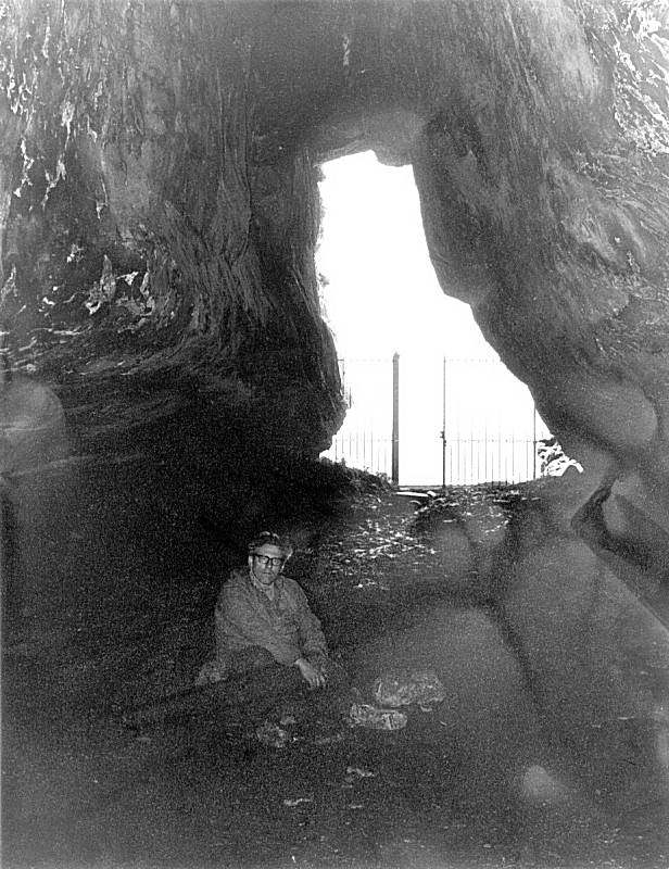
| Dimension: | L=37 m, W=9 m. |
| Guided tours: | self guided |
| Photography: | allowed |
| Accessibility: | no |
| Bibliography: |
King’s Cave and Drumadoon
Arran Geopark leaflet.
pdf
|
| Address: |
Arran Geopark, Arran Access Trust, Tel: +44-7851-293489.
E-mail: |
| As far as we know this information was accurate when it was published (see years in brackets), but may have changed since then. Please check rates and details directly with the companies in question if you need more recent info. |
|
History
| 1306 | King Robert the Bruce I. was probably hiding in this cave after a lost battle. |
| 1909 | cave excavated with underwhelming results. |
Description
The cave at Drumadoon is now called the King’s Cave after Robert the Bruce but in earlier times was identified with the legendary Fionn and called Fionn’s Cave. The cave has several Viking carvings on the central pillar. The most interesting one seems to represent a man holding what might be a bow over the top of his head. However, it is not known, what the instrument really represents. Another carving might be a two handed sword or cross, suggesting that the cave might once have been used for religious purposes. Other carvings include the image of a horse, crosses, deer, and a group of snakes.
During the stay of Robert the Bruce in Arran, presumably at Whiting Bay, he met the Arran woman with second sight, who predicted that he would eventually free Scotland from the enemy. In order to show her own faith in the prophecy she had made, she sent her two sons in his service.
This large sea cave was formed about 10,000 to 6,000 years ago, when the cave was located at sea level. During the ice age northern Europe was covered by an up to 3.5 km thick ice shield. This enormous weight pressed the continental crust into the mantle, even here at the end of the glacier. The cave was located at sea level and the sea created the cliffs of Drumadoon and most other cliffs around Arran. After the ice was molten and the crust released from the weight an uplift powered by isostatic forces started. This process is still ongoing in the central Scandinavian area, but here it is over. The coast line including the sea caves was raised, the geologic term is raised shoreline.
- See also
 Robert the Bruce and the spider
 Search DuckDuckGo for "King’s Cave Drumadoon"
 Google Earth Placemark
 Arran, Drumadoon, King’s Cave - Canmore (visited: 30-JUN-2021)
- King’s Cave (visited: 30-JUN-2021)
- The Isle of Arran: Auchagallon Cairn, the King’s Cave and Drumadoon Point (visited: 30-JUN-2021)
- King’s Cave and the legend of Robert Bruce and the spider (visited: 30-JUN-2021)
- Midland Valley (visited: 30-JUN-2021)
 Index
Index Topics
 Hierarchical
 Countries
 Maps
Maps