Ayres Natural Bridge
Useful Information
| Location: |
near Douglas, Converse County.
I-25 to exit 151, 16 km west of Douglas, turn south and follow the signs, 6 km.
(42.734182, -105.612070) |
| Open: |
15-APR to 15-OCT daily 8-20. [2021] |
| Fee: |
free. [2021] |
| Classification: |
 Natural Bridge Natural Bridge
|
| Light: | n/a |
| Dimension: | W=30 m, H=15, |
| Guided tours: | self guided |
| Photography: | allowed |
| Accessibility: | no |
| Bibliography: | |
| Address: | Ayres Natural Bridge Park, 208 Natural Bridge Rd, Douglas, WY 82633, Tel: +1-307-358-3532. |
| As far as we know this information was accurate when it was published (see years in brackets), but may have changed since then. Please check rates and details directly with the companies in question if you need more recent info. |
|
History
| 1843 | first written mention by a pioneer, who described it as "a natural bridge of solid rock, over a rapid torrent, the arch being regular as tho’ shaped by art." |
| 1870 | geological survey explored the site. |
| 1882 | Alvah Ayres, an early day freighter and bull whacker, settled on the land. |
| 1919 | The son of rancher Alvah Ayres donates the bridge and 15 acres surrounding it to Converse County. |
| 1920 | park established. |
Description
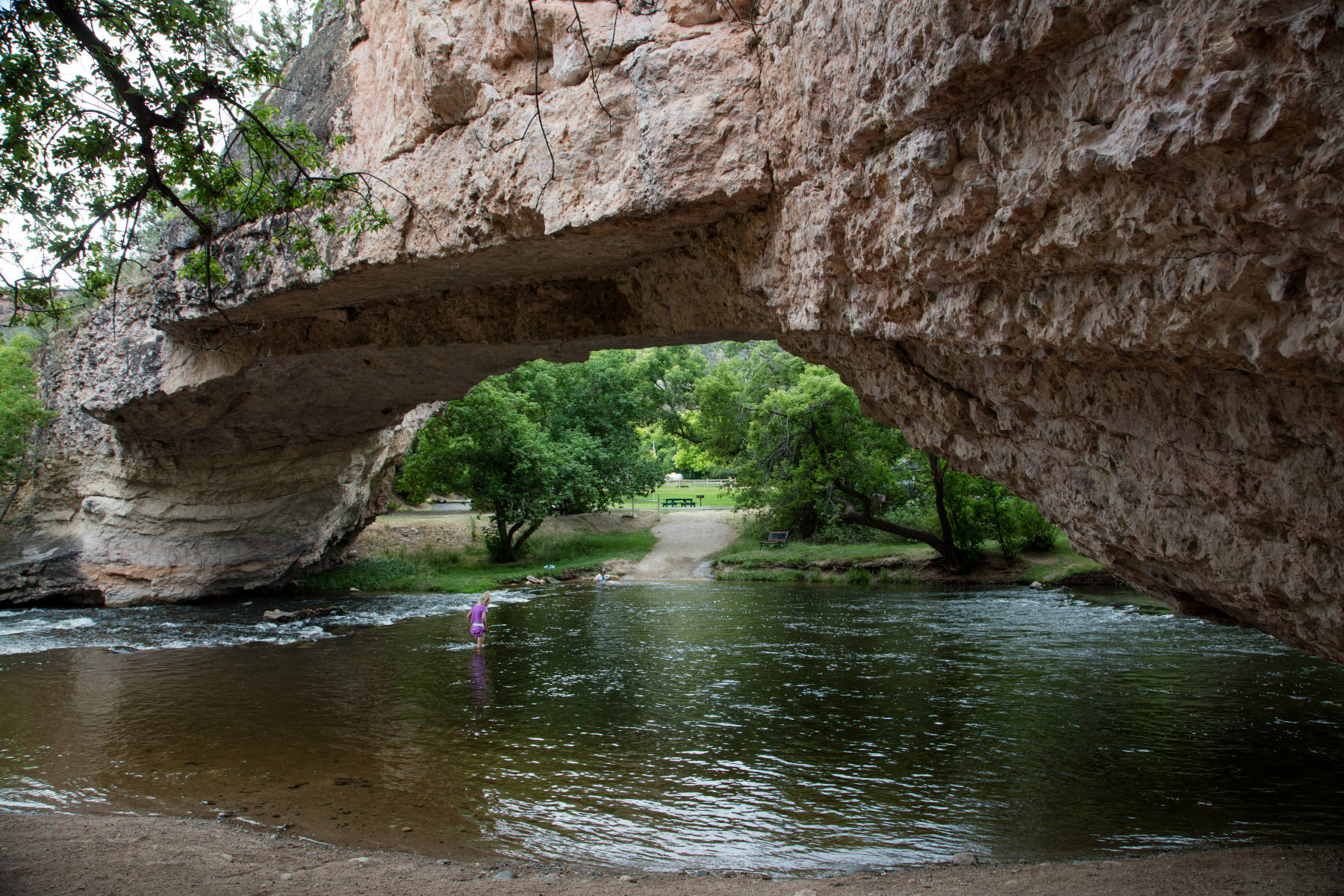
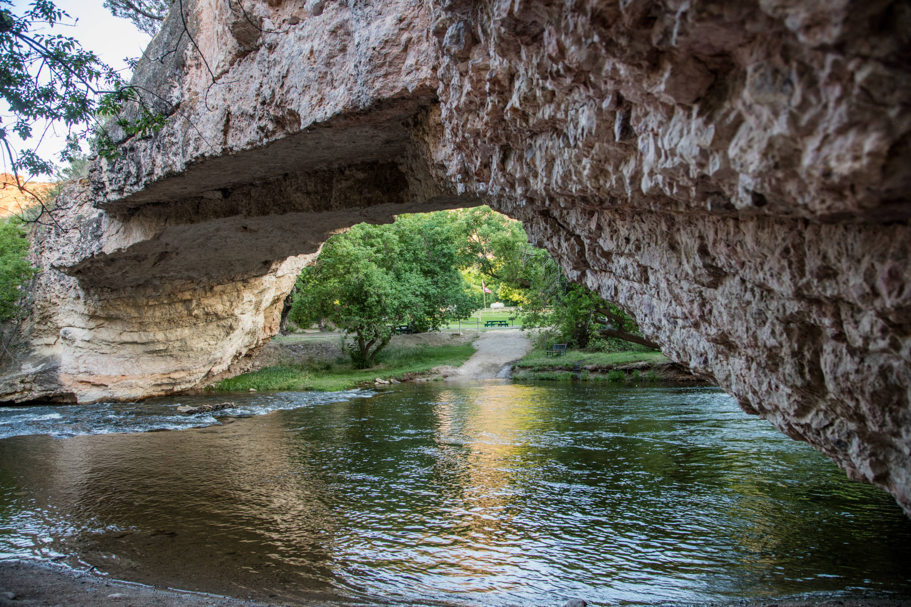
Ayres Natural Bridge is located south of the Oregon Trail. They state that it is one of only three natural bridges in the United States with water beneath. A fact we never heard before, actually. Not the fact that this bridge has water beneath, the fact that only three natural bridges in the United States have water beneath. That’s quite astonishing, as natural bridges are normally a karst feature, the remain of a collapsed cave where only a small part of the cave ceikling is not yet collapsed and forms a bridge.
This natural bridge is actually not a karst cave, it is the late stage of an incised meander spur. A river which flows through a plain forms huge meanders, when the river cuts into the rock they become incised. The river is redirected at every bent, so its force is concentrated on the outside of the bow. At the foot of such a meander the meander spur thus becomes thinner and thinner, and finally the upper and lower part of the rivers meet and the river takes the newly created shortcut through the cave.
In other words: this cave was formed by mechanical forces, by the erosion of the LaPrele Creek, formerly known as Bridge Creek. For such caves the type of rock does not matter, they can form in any kind of rock. In this case its the sandstones of the Casper Formation, of Pennsylvanian Age, 280 Ma old. The layer where the opening is located has a white colour, this layer is topped by a reddish sandstone, so the meander forms an amphitheater of red sand stone walls.
For non-Americans, it is probably necessary to explain the term Oregon Trail. This is not a long distance walking trail, like the Appalachian Trail, it is actually a famous route which was used by white settlers in the 19th century across the country to Oregon and the west coast. It made use of the natural passages in the Rocky Mountains, so it was suitable for the large-wheeled wagons of the emigrants. This area was a haven for white settlers passing through Wyoming. Legend has it that an Indian was struck by lightning and killed on top ot the bridge, and so they avoided the whole area. As a result the natural bridge was often visited by emigrants. In 1843 a pioneer described it as, "...a natural bridge of solid rock, over a rapid torrent, the arch being regular as tho’ shaped by art..."
The Ayres Natural Bridge was named after the Ayres family, who once owned this land. Alvah Ayres, an early day freighter and bull whacker, settled on the land in 1882. The bridge was a small part of his ranch and his son donated the bridge and 15 acres surrounding it in 1919 to Converse County. One year later they created the park, which grew a few years later with another donation to a size of 150 acres.
The pictures on this page are from Carol M. Highsmith, who made an impressive series of rural America. She photographs the entire American vista, including landscapes, architecture, urban and rural life, and people in their work environments, in all fifty U.S. states as a record of the early 21st century. Highsmith donated her life’s work of more than 100,000 images, royalty-free and in highest possible quality, to the Library of Congress, which established a free one-person archive.
 Search DuckDuckGo for "Ayres Natural Bridge"
 Google Earth Placemark
 Ayres Natural Bridge Park - Wikipedia (visited: 30-MAY-2021)
 Ayres Natural Bridge, official website (visited: 30-MAY-2021)
 Index
Index Topics
 Hierarchical
 Countries
 Maps
Maps