Waimea Canyon
Useful Information
| Location: | On the southwestern side of Kauai island. The Hawaiʻi state road 550 begins at Waimea and leads to the upper end of the canyon. (22° 03′ 22″ N, 159° 39′ 55″ W) |
| Open: |
no restrictions. [2020] |
| Fee: |
free. Parking: Non-Residents USD 10, Residents free. [2020] |
| Classification: |
 Gorge Gorge
|
| Light: | n/a |
| Dimension: | L=16 km, VR=900 m. |
| Guided tours: | n/a |
| Photography: | allowed |
| Accessibility: |
outlooks: yes. canyon: no |
| Bibliography: | |
| Address: | Waimea Canyon State Park, Waimea Canyon Dr, Kauai, HI 96752 |
| As far as we know this information was accurate when it was published (see years in brackets), but may have changed since then. Please check rates and details directly with the companies in question if you need more recent info. |
|
History
| 1869 | Waimea Canyon dubbed the Grand Canyon of the Pacific by American explorer John Wesley Powell. |
Description
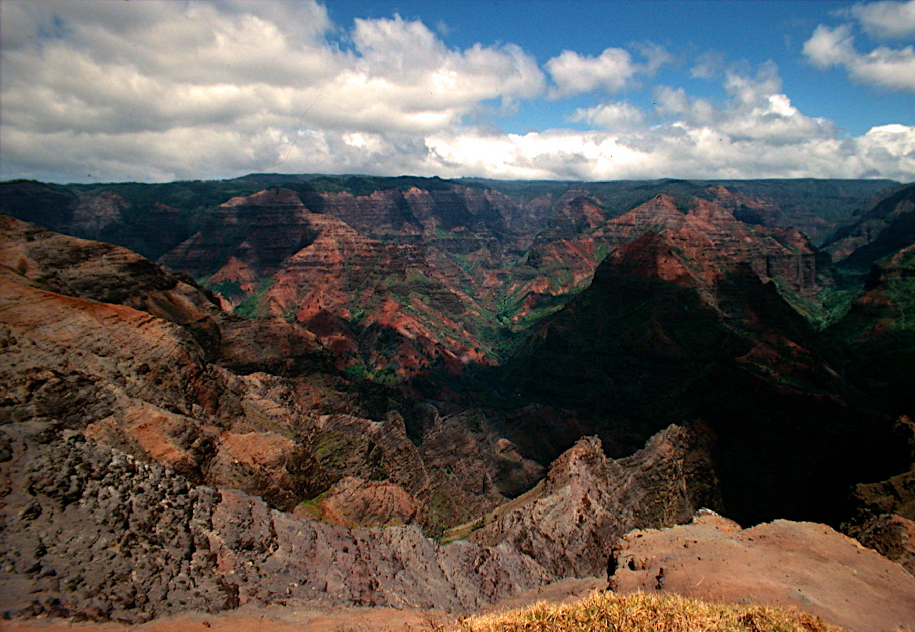
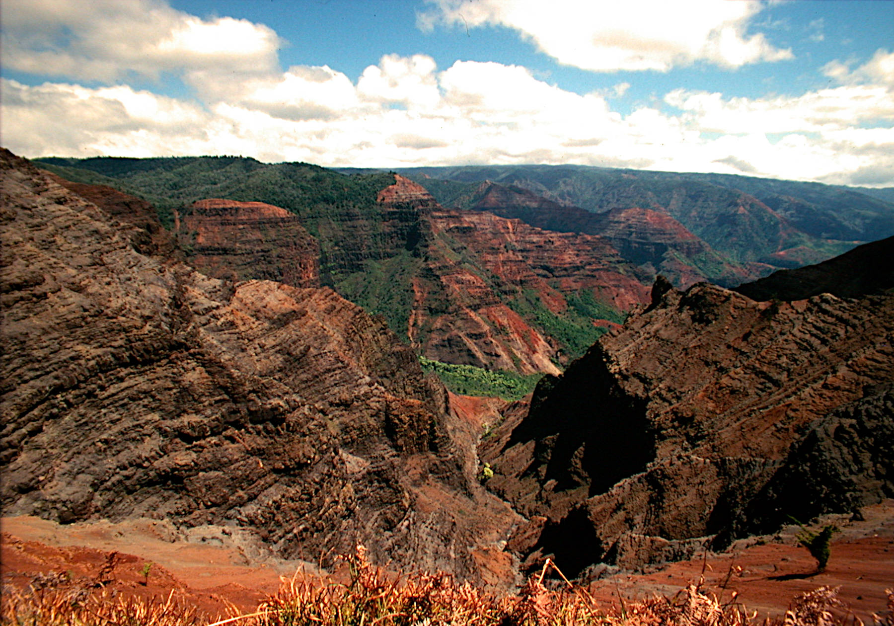
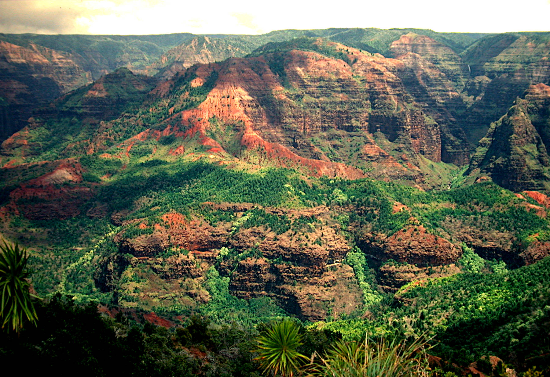
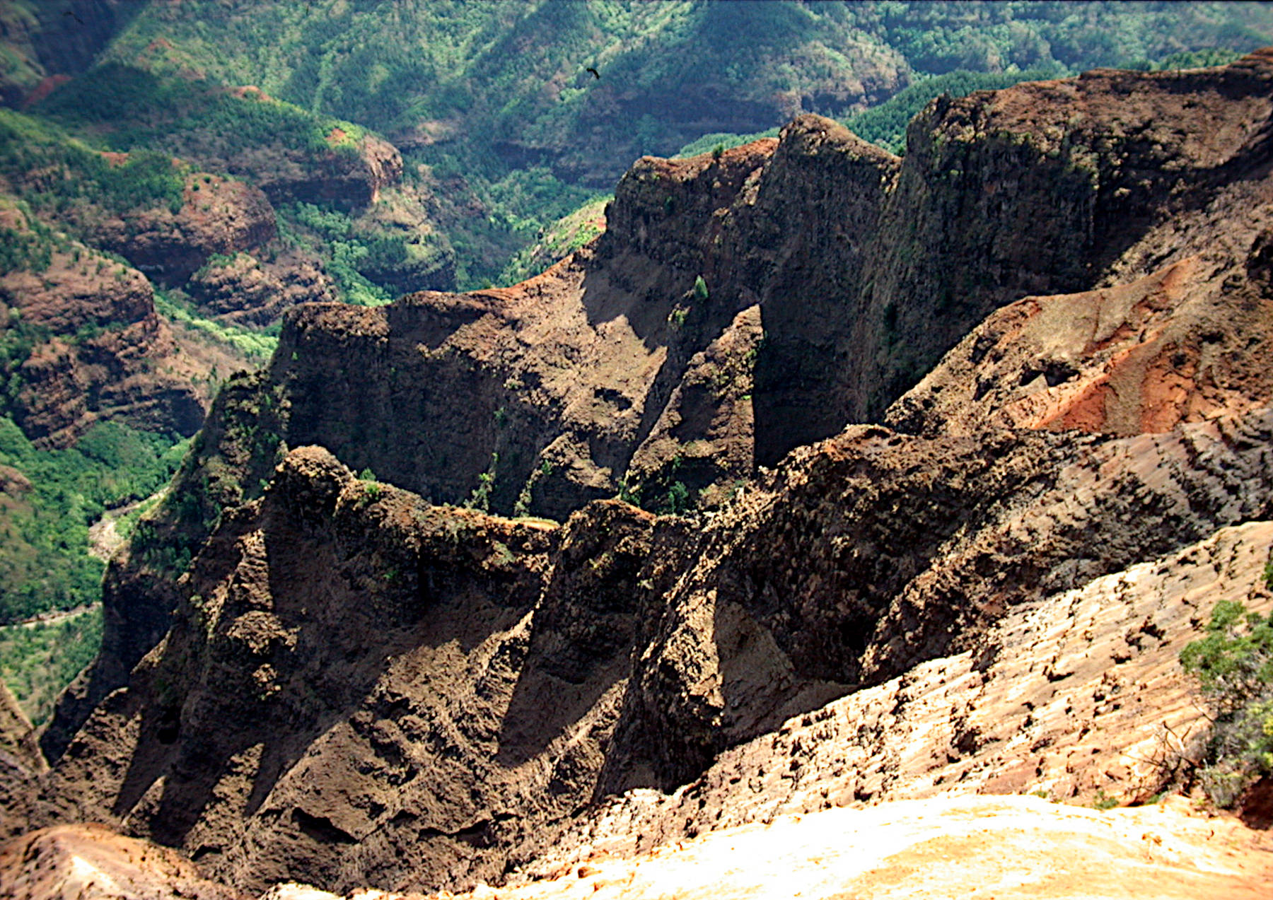
Waimea Canyon is not only the biggest canyon on Hawai’i, it is also the Grand Canyon of the Pacific. This moniker is often attributed to Mark Twain, but is was actually coined by American explorer John Wesley Powell who visited Kauai in 1869. Waimea is the Hawaiian word for reddish water, a reference to the colour of the Waimea River caused by the erosion of the canyon walls. The basalt contains small amounts of iron which oxidizes under high temperatures to the red pigment Fe2O3. There is a town at the coastal road with the same name, and two roads starting to the north. The lower road goes into the canyon along the river, some people are actually living here, but the road ends after only 3 km. Of course you can walk from here. The other road is the rim road, Hawaiʻi state road 550 or Waimea Canyon Drive, running along the western rim of the canyon, with numerous outlooks into the canyon.
The rim road was built only 100 m from the rim, but due to the vegetation it is normally not possible to see the canyon while driving. Thats probably a good thing, otherwise there would be lots of accidents by tourists guffawing at the canyon instead of looking at the road. But there is still some potential for accidents by people parking along the road as soon as there is a glimpse of canyon between the brushes. We recommend to stop at the half dozen official outlooks instead, they have not only parking space but also brush free outlooks.
From the outlooks at the upper end of the canyon, you can see a flat hill on the other side, some would call it a plain. Quite often you can’t see it, because there are clouds, actually its the easiest way to find it: clouds on a completely cloudless day! This is Mount Waiʻaleʻale, the summit of the island Kaua’i and the wettest point on Earth. One of them actually, as there are several which claim to be the wettest, and all are right. But the important point is: do not walk there, unless you have the best rain protection equipment which exists, or you simply dont care about water and boggy ground.
Fortunately on this side of the canyon the weather is much better. So the main consequence is for photographers: do the trip in the afternoon. The road is on the western side and the clouds are on the eastern side. If you want sunshine in the canyon you have to wait for afternoon.
The Waimea Canyon is a result of erosion, but the reason why it is so big is tectonic. When the island Kaua’i was formed, the volcano erupted and produced layer above layer of basaltic lava flows. More than 5 Million years ago the island reached the surface and continued growing. But 4 Million years ago the island became unstable and collapsed. The western part broke off and slid down a fault line. This created a huge depression at the western slopes of the volcano which then filled with lava flows. Waimea Canyon was formed by the river draining this huge depression.
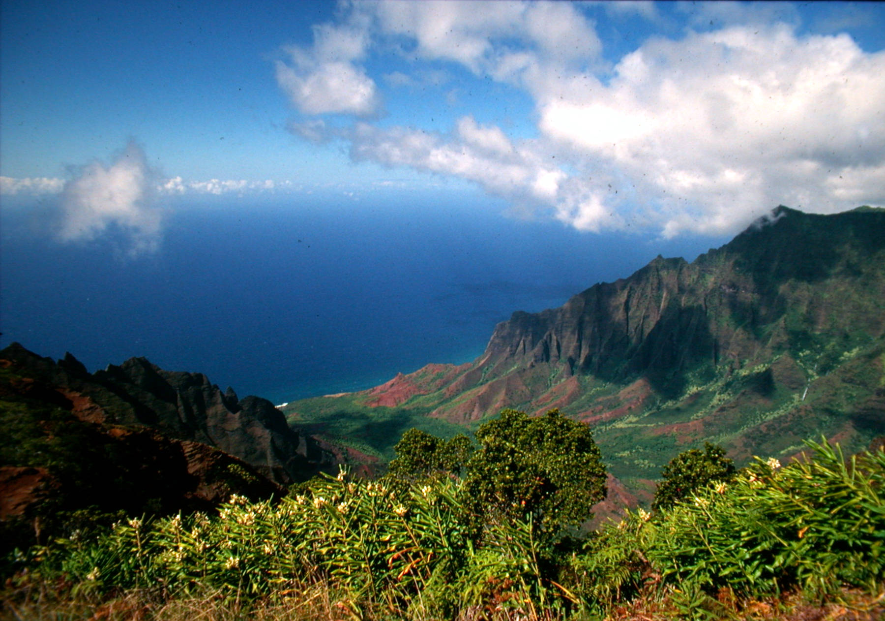
The last outlook at the end of the road, Pu’u O Kila Lookout, is looking to the north and the Na Pali coast. Here you can see the green mountains from Jurassic Park, the only possibility to see them except on helicopter flights. This is the end of the road and you have to walk a few meters on the Pihea Trail for the best view. Of course there are various trails, two leading down to the coast and one along the plateau.
 Search DuckDuckGo for "Waimea Canyon"
 Google Earth Placemark
 Waimea Canyon State Park - Wikipedia (visited: 20-JUN-2020)
 Waimea Canyon State Park (visited: 21-JUN-2020)
 Index
Index Topics
 Hierarchical
 Countries
 Maps
Maps