Kaaterskill Falls
Cauterskill Falls
Useful Information
| Location: |
Catskill, New York.
Follow Road 18 east from Haines Falls 2.5 km, turn right on Laurel House Road. Trailhead at the end of the road. (42.193234, -74.063044) |
| Open: |
No restrictions. [2020] |
| Fee: |
free. [2020] |
| Classification: |
 Erosional Cave Erosional Cave
|
| Light: | n/a |
| Dimension: | Falls: VR=79 m, A=609 m asl. |
| Guided tours: | self guided |
| Photography: | allowed |
| Accessibility: | no |
| Bibliography: | |
| Address: | |
| As far as we know this information was accurate when it was published (see years in brackets), but may have changed since then. Please check rates and details directly with the companies in question if you need more recent info. |
|
History
| 1753 | visited by early American naturalist John Bartram and his son William. |
| 1819 | mentioned by Washington Irving in his story Rip Van Winkle. |
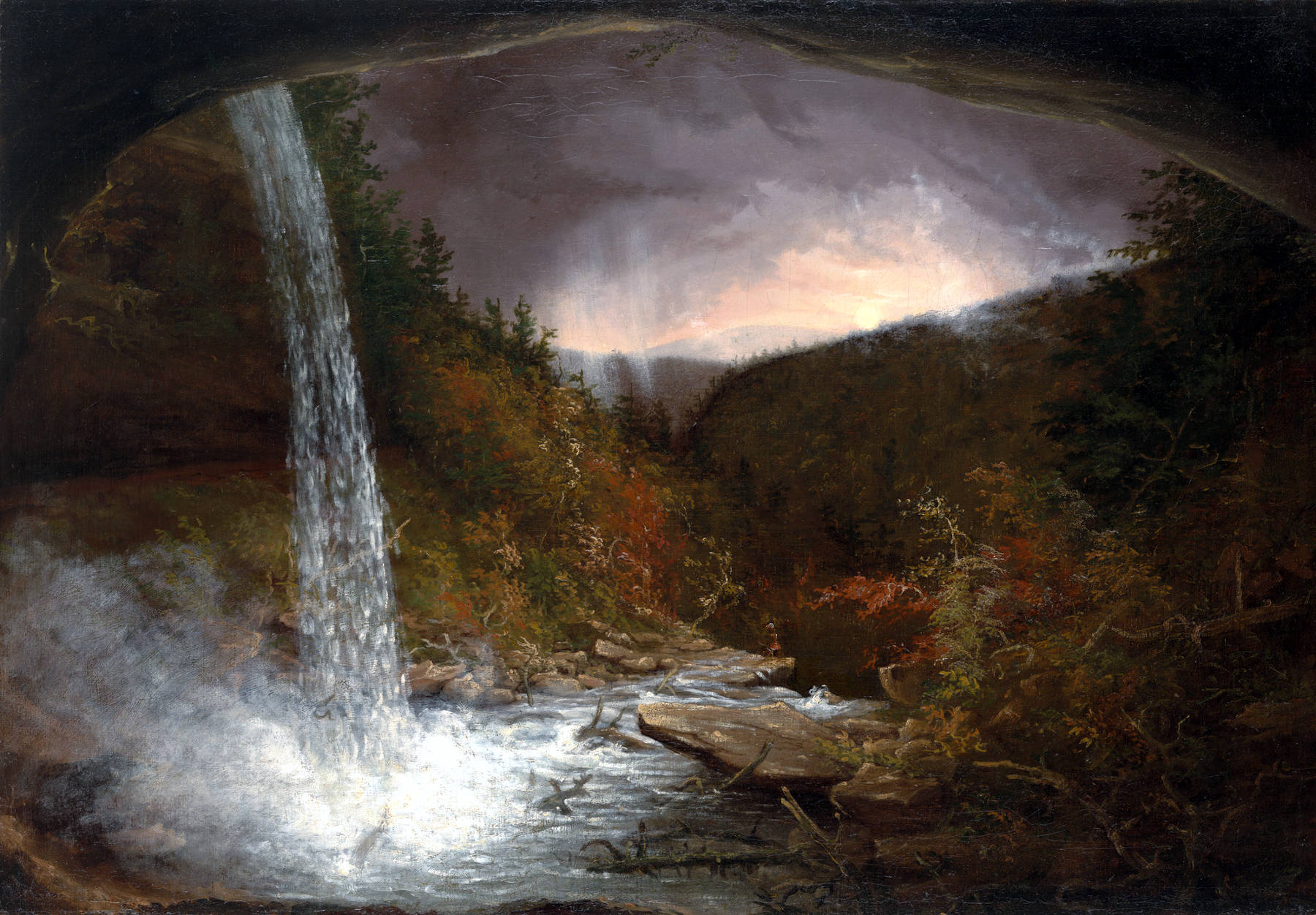
| 1825 | painted by artist Thomas Cole. |
| 1885 | Forest Preserve established by New York State. |
| 1967 | Kaaterskill Falls Trail built as the southern terminus of the Escarpment Trail. |
| 1980s | trail above the falls closed and new southern section along Schutt Road built. |
| 2016 | new trail from Laurel House trailhead. |
Description
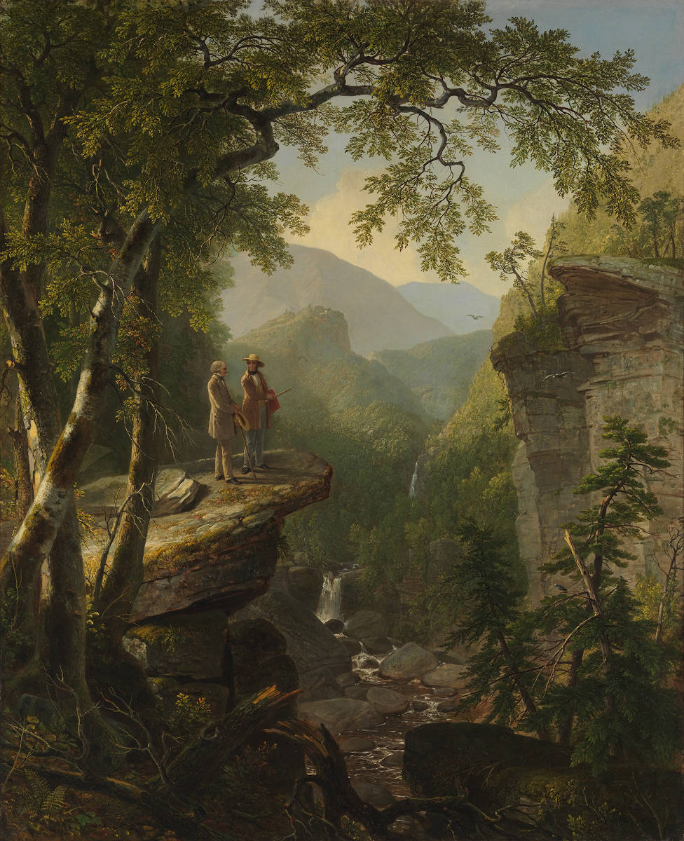
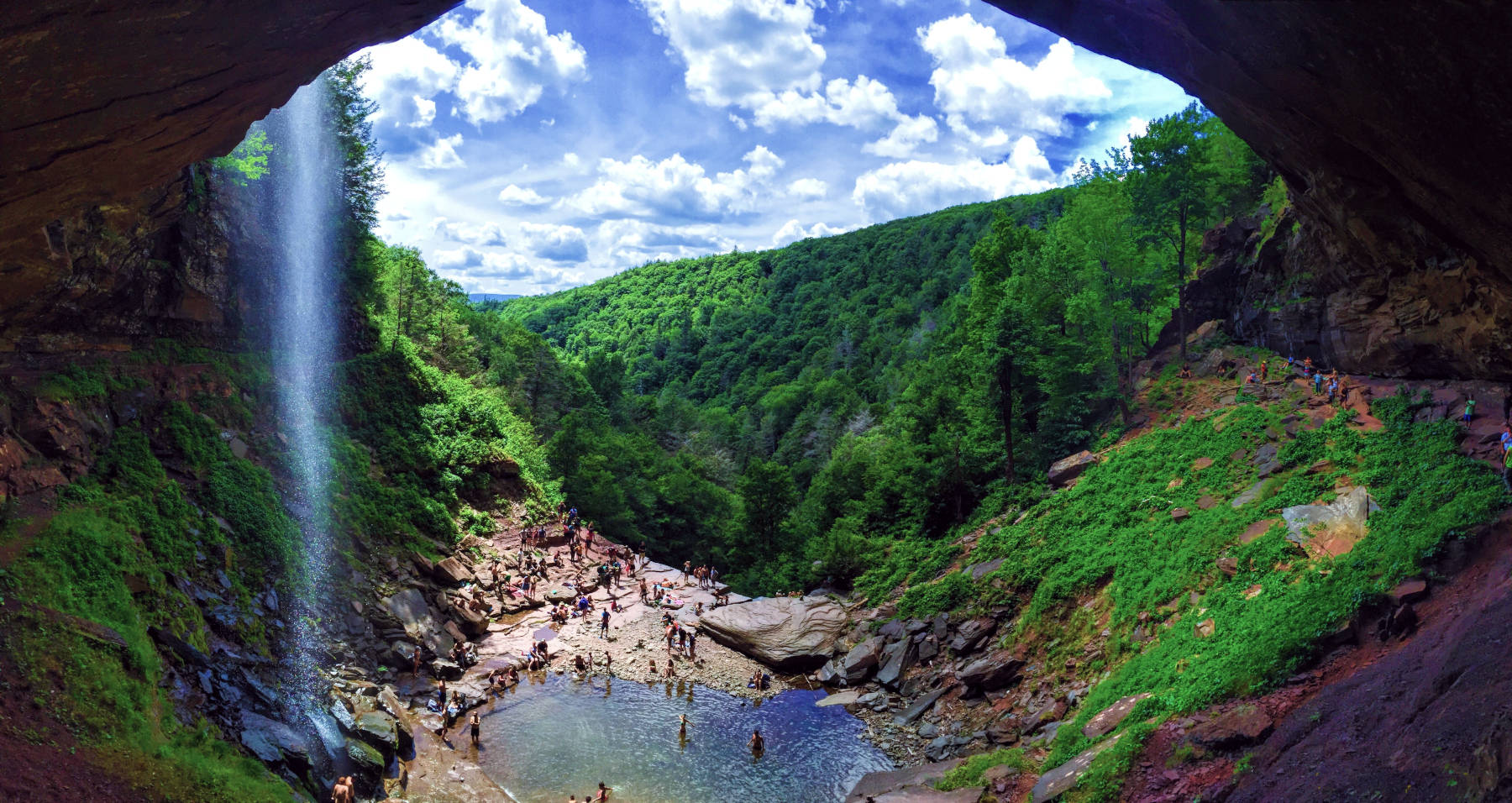
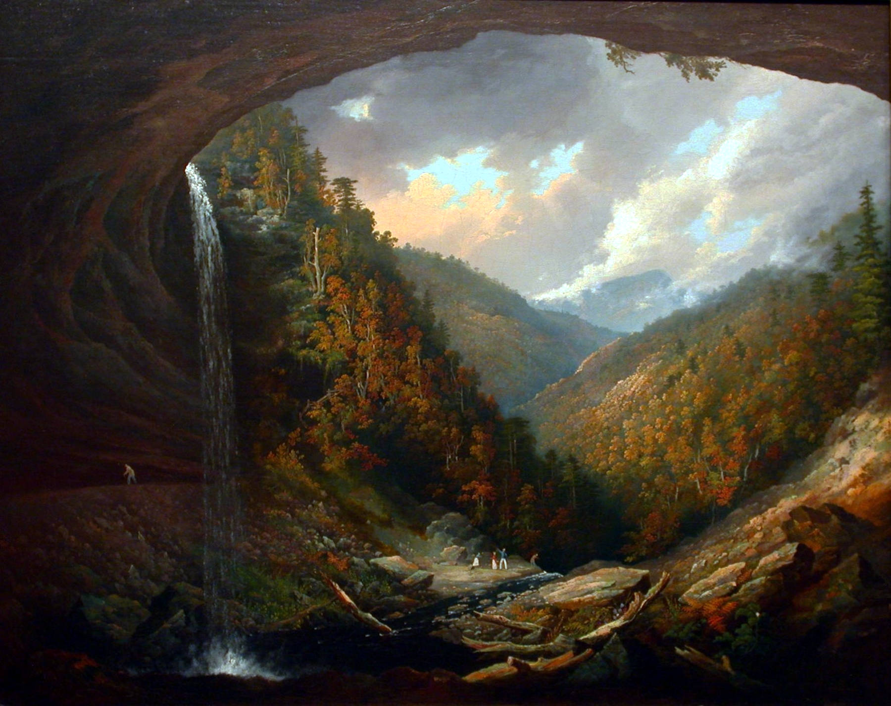
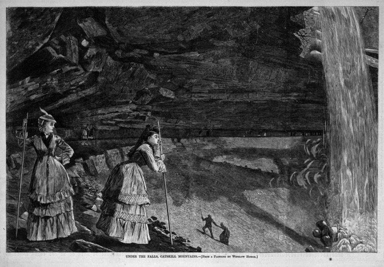
The Kaaterskill Falls are a two-stage waterfall on Spruce Creek in the eastern Catskill Mountains of New York State. Together they are 79 m high, which makes them one of the highest waterfalls in New York. The falls were formed at the end of the Illinoian Stage about 130,000 years ago by runoff from the glacial melt. The melting water formed North-South Lake and then began to flow down the steep slopes of the newly created clove. The erosion started at the lower end and the retrograde erosion cut the Spruce Creek gorge into the mountain side, always with a waterfall at its end. The waterfall created a natural amphitheater with a huge cavern behind the fall and a pool at its feet.
Indigenous peoples of the Hudson Valley knew about the falls for a very long time. But they never lived at the Catskill Mountains due to the high elevation which made agriculture difficult. They only went there for hunting. The European settlers named the Catskill Mountains, with kats meaning Bobcat or Mountain Lion and kill, the Dutch word for creek. Nicolaes Visscher I’s 1656 map of New Netherland located the Landt van Kats Kill at the mouth of Catskill creek. The name was anglicized by English speaking settlers and became Catskills, while the name of the falls was even more corrupted to Kaaterskill.
The early American naturalist John Bartram and his son William made a famous expedition to the area in 1753. He wrote about it in his travelogue A Journey to Ye Cat Skill Mountains with Billy which became widely read not only in the colonies but back in Britain as well. But the falls became really famous when Washington Irving mentioned them in his story Rip Van Winkle in 1819. Artists like Thomas Cole painted the falls and nearby Palenville became the first art colony in the United States. The area became a famous tourist destination and and there were numerous enterprises based on this tourism. The weirdest was possibly the Laurel House hotel which acquired the water rights to Kaaterskill Creek. They dammed the river above the falls and charged spectators below the falls a fee to watch as the waters. The waterfall was dry until the fee was payed, then the waterfall was activated.
The whole area was bought by New York State and transformed into a Forest Preserve, which protect the area from logging and commercial development. Tourism changed, the hotels became bankrupt or burned down, and were also included into the preserve. The gorge below the falls is crossed by New York State Route 23A, the only road through the clove. Here are two parking lots and visitors to the falls had to walk along the road for 400 m to the trailhead at Bastion Falls at a bend in the road. This was quite dangerous as there were many cars and trucks on the road. The second problem was the trail up the valley, which climbs rather steeply along the steep and rocky slopes of the creek. Since 2016 the access was changed, there is a new trail from the north accessing the falls from above. It uses Laurel House road, which was named after Laurel House hotel. The hotel is gone since the 1967 but the road and the trail is still there. It was improved and allows now wheelchair access to an overlook platform. There is a 35 m hiking bridge over Spruce Creek, and a new foot trail with stone staircase down to the middle pool. Half down a side branch leads into the cave.
There were numerous safety problems with the trails and a number of visitors were injured or died. The most dangerous sections were the escarpment above the fall, the trail in the cave, and the situation with the access from Route 23A. First the Kaaterskill Falls Trail was relocated, the access from below was blocked, though it is still used by many visitors. A woman fell from the top of the falls into the pool and sued the state in 2004. That’s a typical thing in the US, but even in the land where McDonalds had to pay for serving hot coffee, the judge ruled against her, saying the danger "was open and obvious to anyone employing the reasonable use of her senses". Nevertheless, the trails were modernised and railings and fences erected.
 Search DuckDuckGo for "Kaaterskill Falls"
 Google Earth Placemark
 Kaaterskill Falls - Wikipedia (visited: 04-DEC-2020)
 Kaaterskill Falls (visited: 14-DEC-2020)
 Index
Index Topics
 Hierarchical
 Countries
 Maps
Maps