Cerknisko Jezero
Cerknica Lake
Useful Information
| Location: |
South of Cercnica.
(45° 46’ N, 14° 24’ E) |
| Open: |
No restrictions. [2025] |
| Fee: |
No restrictions. [2025] |
| Classification: |
 Polje
Karst Lake
Ponor Polje
Karst Lake
Ponor
|
| Light: | n/a |
| Dimension: | Maximum Area 26 km². |
| Guided tours: | self guided |
| Photography: | allowed |
| Accessibility: | yes |
| Bibliography: | |
| As far as we know this information was accurate when it was published (see years in brackets), but may have changed since then. Please check rates and details directly with the companies in question if you need more recent info. |
|
Description
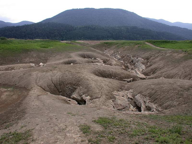

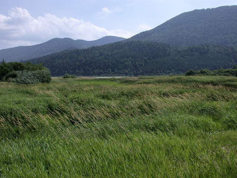
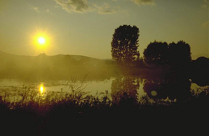
Cerknisko Jezero (Cerknica Lake) is a so-called seasonal lake or karst lake. As the water of the lake is connected directly with the water table, its level shows the level of the water table. The bed of the lake is connected to a large but mostly inaccessible subterranean labyrinth that spews out or swallows up the water. In other words, the outflow is more or less constant, but the inflow by precipitation and snow melt changes over the year. If there is more rain the level rises and the plain is flooded, if inflow is low, the groundwater level sinks and as well the level of the lake, which shrinks. The maximum surface area of the lake is normally 26 km², 7.4 km long and 3.3 km wide. During extreme floods it may reach 38 km², 10 km long and 5 km wide. The water level ranges between 546 and 551 m asl, the deepest spot is 10 m deep. In the summer it shrinks into a number of small puddles, only one of them is permanent.
The strange behaviour of the lake was already noticed by the ancient Romans who had no explanation for it.
A description of it gained the 17th century Carniolan historian
 Johann Weichard Frh. von Valvasor, honorary membership in the Royal Geographical Society in London.
The way how this behaviour could be explained was first published by
Johann Weichard Frh. von Valvasor, honorary membership in the Royal Geographical Society in London.
The way how this behaviour could be explained was first published by
There are numerous tributaries to the lake. In Loško polje in the southwest, the Loški Obrh river sinks in the Golobina požiralnik and springs after 1.7 km underground in Cerknica Field in two springs, the Cemun spring and Čolniči Obrh. There seem to be differences in the naming of the river, on some maps it is called Jezerscica, on others Jezerski Obrh and on still others Štržen. Similar springs with short rivers can be found all along the eastern side of the lake. One is located in the southwestern corner near Otok, one is at the foot of the Velika Slivnica (1114 m asl) on the northern side. And there is one main river named Cerkniščica which flows through the town Cerknica.
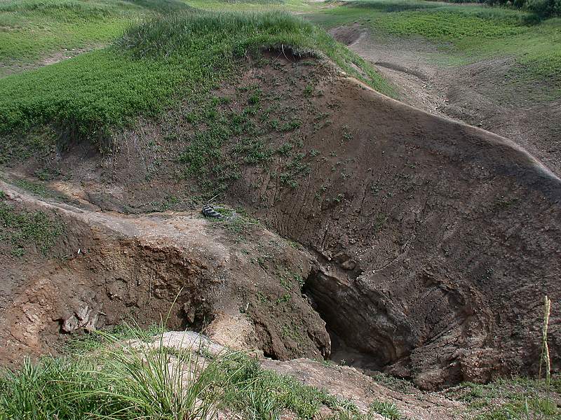
The water leaves the lake again through several groups of ponors in the middle of the lake, and through a river which flows west
An island with a little village named Dolenje Jezero is located at the center of the lake. It also has a small museum about the lake with a 3D plaster model which simulates the changing water levels. This museum is named Muzej Cerkniškega jezera (Museum of Lake Cerknica). It was created by the Kebe family in their former barn, and offers a geological exhibition as well as historical exhibitions with local history, traditions, handcraft, and typical architecture.
As the lake has many fish, and the locals have a tradition of fishing, there were always people who would have preferred a larger residual lake. A few years ago this was accomplished artificially. In the middle of the lake area, not far from the main ponors but on a spot of sea floor which is covered by a thick impermeable layer of clay, they built a dam. So when the lake vanishes the water inside the dam remains and offers a home to the fish while the lake is gone.
 Search DuckDuckGo for "Cerkniško Jezero"
 Google Earth Placemark
 Index
Index Topics
 Hierarchical
 Countries
 Maps
Maps