Nilometer
Al-Roda Nilometer - Nilometer of Rhoda Island
Useful Information
| Location: |
Al-Miqyas Street, Southern Tip of Al-Roda Island.
(30.006916, 31.225007) |
| Open: |
All year daily 9-17. [2022] |
| Fee: |
Adults EGP 40, Children EGP 20. [2022] |
| Classification: |
 Water Supply Water Supply
|
| Light: |
 Electric Light Electric Light
|
| Dimension: | |
| Guided tours: | D=30 min. |
| Photography: | allowed |
| Accessibility: | no |
| Bibliography: |
Helaine Elsin (2008):
Nilometer
Encyclopaedia of the History of Science, Technology, and Medicine in Non-Western Cultures, p. 1753.
Kluwer Academic Publishers 1997, 2nd edition 2008.
wikipedia
|
| Address: | Nilometer, Cairo, 2 Al Malek Al Saleh St. - Manial Al Rawda, Egypt. |
| As far as we know this information was accurate when it was published (see years in brackets), but may have changed since then. Please check rates and details directly with the companies in question if you need more recent info. |
|
History
| 715 | Nilometer built, ordered by Usāma bin Zayd bin ʿAdī. |
| 830 | visited by the Syrian Orthodox patriarch Dionysius of Tel Mahre. |
| 861 | current Nilometer built, replacing an older one at the same site, ordered by the Abbasid caliph al-Mutawakkil. |
| 1825 | dome destroyed during the French occupation. |
Description
A Nilometer is a unique sensor system which is actually 5000 years old. It was invented to predict the future and was used successfully for millennia. On the first glimpse it is just a well, dug vertically into the mud, close to the river. The Nilometer of Rhoda Island was built in 861 and replaced an older one at the same site. Its construction was ordered by the Abbasid caliph al-Mutawakkil. It was overseen by the astronomer Alfraganus, who was also responsible for the design. The previous nilometer was ordered in 715 by Usāma bin Zayd bin ʿAdī, who was in charge of collecting the kharaj (land tax). He worked for for the Umayyad caliph Sulaymān ibn ʿAbd al-Malik. It is considered the most important Nilometer from the Islamic period.
In ancient Egypt, the behavior of the Nile was important for the fertility of the land, and as a result for expected harvest. The river flooded the fields and irrigated them, and at the same time mud was deposited which was new fertile soil. Low water levels meant drought, which would mean famine. If the water level was higher, the fields of the valley floor, the flood plain, were flooded and the harvest was good. But if it was even higher, there was the danger of destruction, which could be catastrophic.
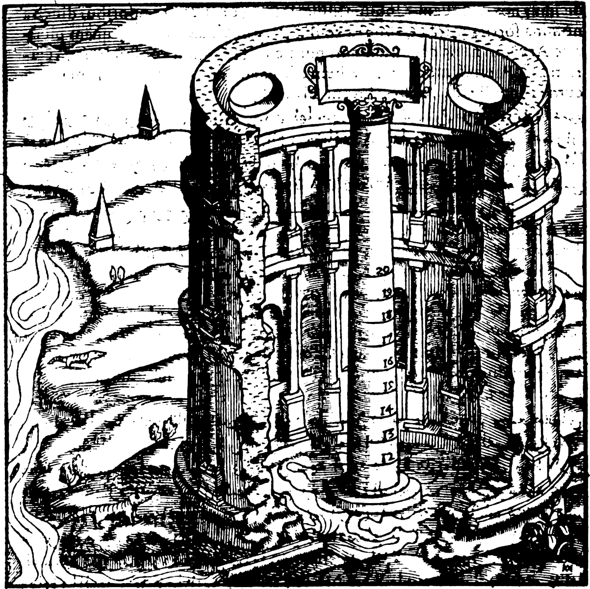
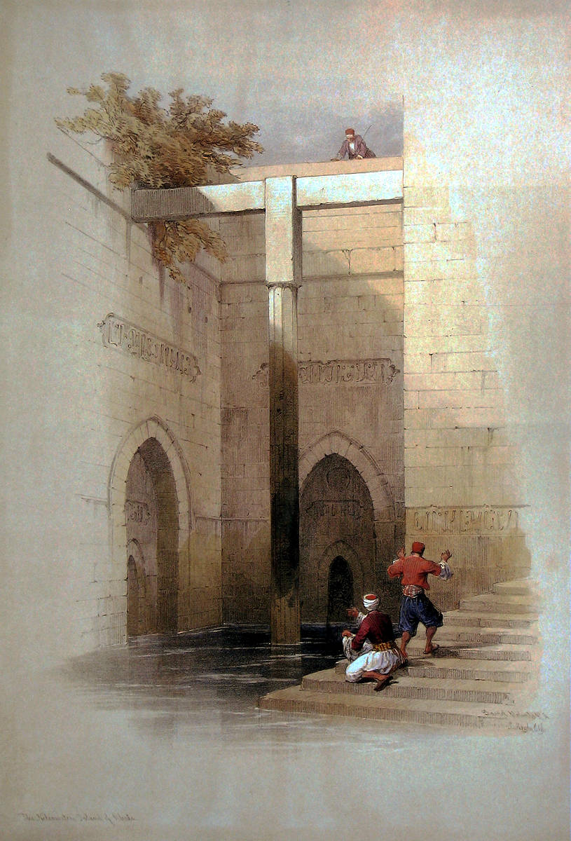
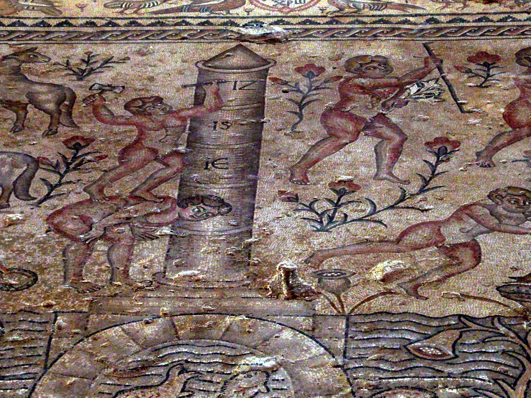
The Al-Roda Nilometer or nilometer on Rhoda Island is a tall column housed in a submerged stone structure called a stilling well. An octagonal marble column is held in place by a wooden beam at the top that spans the width of the well. The stilling well is quadratic and has a staircase down the walls, so priests, who were in charge of monitoring the nilometers, could walk down and examine the column. The nilometer was measuring the level of the Nile, so the water in the well is connected with the nearby flowing Nile river. According to the law of communicating vessels, the water level is the same outside and inside. Three tunnels at different levels connected the Nile with the well. This design is based on the design by Afraganus, a famous astronomer.
Only priests and rulers, whether pharaohs or later, Roman or Arab leaders, were allowed to monitor the nilometers, and their ability to predict the behavior of the Nile was used to impress the common people. Some say it was mainly used to determine how much money would be collected in taxes. That’s actually correct, the height of the tax depended on the flood. As a result most nilometers were built in temples, where only priests could access the mysterious instrument. On the other hand the priests were educated and were able to measure accurately, regularly, and write down the results. They also noted the clarity of the water, not only the level. And while it was just an instrument for measuring, it was so important, its interior is ornately carved.
Between July and October every year the Nile river flooded the adjacent flood plain. This was one of the three seasons into which the ancient Egyptians divided their year, called akhet (Season of the Inundation). The waters receded in September or October, they left behind a rich alluvial deposit of exceptionally fertile black silt. There were Nilometers all along the river, which allowed to detect the movement of the flood. The Aswan Dam ended the floods and rendered the Nilometers obsolete in the 1960s.
Today the Nilometer is an archaeological site and a tourist sight. The three tunnels which once let water in, were filled in, so visitors can walk all the way down.
There were three kinds of nilometers, the first was the stilling well connected to the river, the second was simply a covered stone staircase leading straight down into the Nile, and the third was a cistern or well which was connected to the Nile by a canal. All of them had indicator markings, which were accessible by staircases for the priests and rulers. And all of them obviously work after the same principles. The name stilling well describes why the level was not simply measured at the river, the separate well provided a calm water level which could be measured.
The site is best reached with Uber or Taxi. With taxi it is recommended to let the taxi wait, because its difficult io find another one here. The visit takes only half an hour.
 Search DuckDuckGo for "Nilometer"
 Google Earth Placemark
 Nilometer - Wikipedia (visited: 04-JAN-2022)
 Nilometer - Atlas Obscura (visited: 04-JAN-2022)
 The Nilometer on Rawda (Roda) Island in Cairo (visited: 05-JAN-2022)
 Index
Index Topics
 Hierarchical
 Countries
 Maps
Maps