Caves of the Great Ocean Road
Port Campbell National Park
Useful Information
| Location: | West of Melburn, along the coast near Port Campbell. Follow B100, signposted. |
| Open: |
no restrictions. [2024] |
| Fee: |
free. [2024] |
| Classification: |
 Sea Cave Sea Cave
 Collapsed Cave Collapsed Cave
 Natural Bridge Natural Bridge
|
| Light: | not necessary/bring electric torch for the caves |
| Dimension: | L=240 km. |
| Guided tours: | self guided |
| Photography: | allowed |
| Accessibility: | No, many steps |
| Bibliography: | |
| Address: |
Port Campbell-12 Apostles Visitor Information Centre, 26 Morris Street, Port Campbell, Victoria, Tel: +61-1300-137-255.
E-mail: |
| As far as we know this information was accurate when it was published (see years in brackets), but may have changed since then. Please check rates and details directly with the companies in question if you need more recent info. |
|
History
| 26-NOV-1932 | coastal road opened. |
| 1964 | Port Campbell National Park was dedicated. |
| 1981 | Port Campbell National Park grew to its current size of 1750 ha. |
| 15-JAN-1990 | the arch closer to the shoreline of London Bridge collapses. |
| 2004 | Great Ocean Walk opened, connecting 104 km of walking trails that follow the coastline. |
| JUL-2005 | one of the nine sea stacks of the Twelve Apostles collapses. |
| 2008 | Royal Automobile Club of Victoria (RACV) lists the road as the state’s top tourism experience. |
| DEC-2020 | Great Ocean Road and Environs Protection Act 2020 went into effect, giving legal protection to the Great Ocean Road. |
| MAR-2023 | the Eastern Maar people are the traditional owners of 8,578 km² including the Twelve Apostles. |
Description
Along the coast between Melbourne and Port Campbell, the Great Ocean Road, one of the most scenic routes of the world, allows the visitor to follow the coastline. Sheer cliffs, offshore islets, towering rock stacks, gorges, arches, blowholes and sea caves. The road, today numbered B100, was opened in 1932, and is listed as an Australian National Heritage. It was built by returned soldiers between 1919 and 1932, and dedicated to soldiers killed during World War I. In other words, it is actually the world’s largest war memorial.
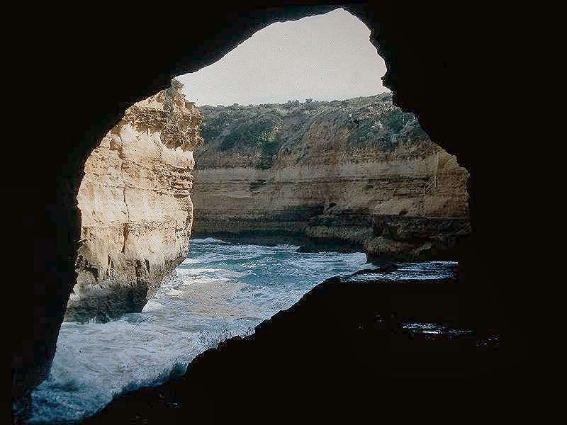
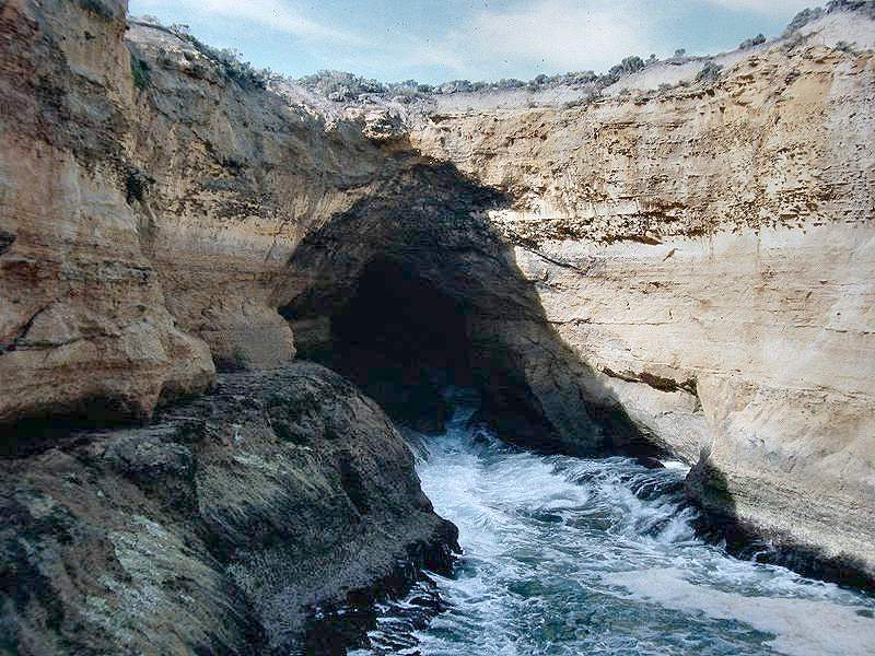
The coastline is formed by a soft Pliocene limestone with karst features. Above sea-level, the limestone is exposed to violent seas and strong winds which have carved out some remarkable features. So many interesting structures are formed by a combination of marine erosion and karst mechanisms. The most impressive sights along the coast are:
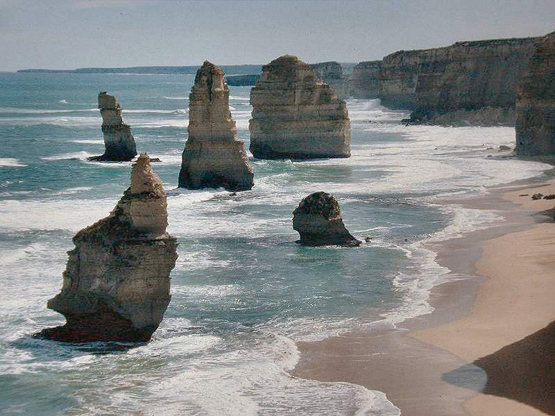
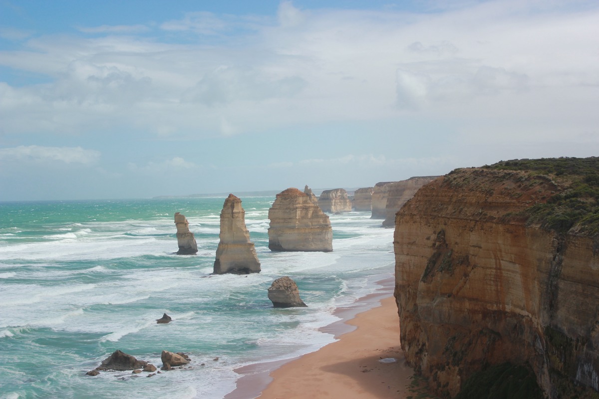
- The Twelve Apostles, twelve characteristic island rocks.
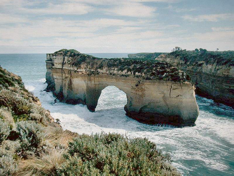
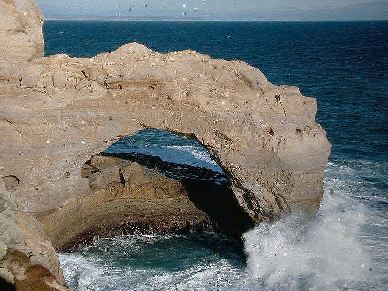
- The Arch, London Bridge and the Grotto
- Loch Ard Gorge
- Thunder Cave
Two small caves are located in Loch Ard Gorge, which was named after the iron clipper Loch Ard after it hit the cliffs just in front of the gorge in June 1878. The caves served as shelter for the two survivors Eva Carmichael and Tom Pearce and are named Carmichael Cave and Tom Pearce’s Cave. Today there is a geological trail explaining the background of the cave, a blowhole and other interesting features.
Not far from Loch Ard lies the Thunder Cave. Despite the name, this is not a cave, it is actually a roofless cave, which collapsed long ago by the ongoing erosional forces of the sea. The plate at this location shows a sketch how the cave might have looked when still a part of the ceiling existed and formed a natural arch. Another interesting geologic formation is the Grotto, a sinkhole altered by the forces of the sea. The place is rather strange, with natural bridges and seawater pools. And last but not least, the natural bridges of The Arch and London Bridge are cave related features, a certain form of sea caves.
Erosion is continually going on at the coast, each wave destroys rock. Now and then one of the spectacular features is too heavily damaged by the ongoing erosion, and it simply collapses. This happens during storms, when strong wind or waves press on the rocks, but sometimes it happens without any external event. On 15-JAN-1990 visitors were on the double arch London Bridge, there was a trail on top, which actually makes no sense, as it is impossible to see the arches when you are on top of them. On this sunny and uneventful day, the arch closer to the shoreline simply collapsed. This event was quite fast and spectacular, there were no warning signs, and two tourists stranded on the outer span and had to be rescued by a police helicopter. Fortunately, noboday was on the arch itself when it happened, so nobody was injured. "London Bridge is falling down..."
Something similar happened in JUL-2005 at the Twelve Apostles. One of the "twelve" sea stacks collapsed, and today only a few unspectacular rocks can be seen in the water. However, the Twelve Apostles were actually nine sea stacks, and now there are only eight of them, but they are still called Twelve Apostles. Those two examples make one thing clear: this is "geology on speed", and it’s definitely a good idea to be very careful when visiting. It’s obvious that more sea stacks will form by the ongoing erosion of the coast, but this process is a little slower. One more comment on the various names. The Twelve Apostles were originally known as the Pinnacles, and the Sow and Pigs, also Sow and Piglets. Muttonbird Island was the Sow and the smaller rock stacks were the Piglets. Such names were given by locals, visitors, and finally by the Tourism Authority.
Australia is quite progressive concerning the return of land to indigenous people. In March 2023, the Federal Court of Australia ruled in favour of the Eastern Maar people as traditional owners. As a result, they are the owners of 8,578 km² of land located in south-west Victoria, including the Twelve Apostles.
 Search DuckDuckGo for "Great Ocean Road"
 Google Earth Placemark
 Great Ocean Road - Wikipedia (visited: 07-APR-2024)
 Great Ocean Road Regional Tourism (visited: 07-APR-2024)
 Index
Index Topics
 Hierarchical
 Countries
 Maps
Maps