Rappenlochschlucht
Useful Information
| Location: |
Gütlestraße, 6850 Dornbirn.
() |
| Open: |
Late-APR to mid-NOV no restrictions. Closed in Winter due to danger of falling rocks. [2025] |
| Fee: |
free. [2025] |
| Classification: |
 Gorge Gorge
|
| Light: | n/a |
| Dimension: | |
| Guided tours: | self guided |
| Photography: | allowed |
| Accessibility: | no |
| Bibliography: | |
| Address: | Rappenlochschlucht, Gütlestraße, 6850 Dornbirn, Tel: +43-5572-22188. |
| As far as we know this information was accurate when it was published (see years in brackets), but may have changed since then. Please check rates and details directly with the companies in question if you need more recent info. |
|
History
| 1791 | Wooden bridge over the Rappenloch Gorge to Ebnit built. |
| 1829 | Rappenloch Gorge Dam planned and built by Vorarlberg district hydraulic engineer Franz Alois Negrelli. |
| 1845 | Bridge destroyed by a fire. |
| 1861 | Rappenloch Gorge dam raised, creating a reservoir, path through Rappenloch built. |
| 1869 | Europe’s highes fountain erected. |
| 1890 | path through Alploch created. |
| 1891 | hydroelectric power station Ebensand built. |
| 1902 | Maintenance path opened to hikers. |
| 10-MAY-2011 | Rockfall destroys Rappenloch Bridge and hiking trail and blocks the drainage. |
| AUG-2013 | New elevated trail opened over the rockfall. |
| 19-MAR-2020 | Another rockfall, bridge closed and then removed. |
| 2023 | New bridge opened. |
Description
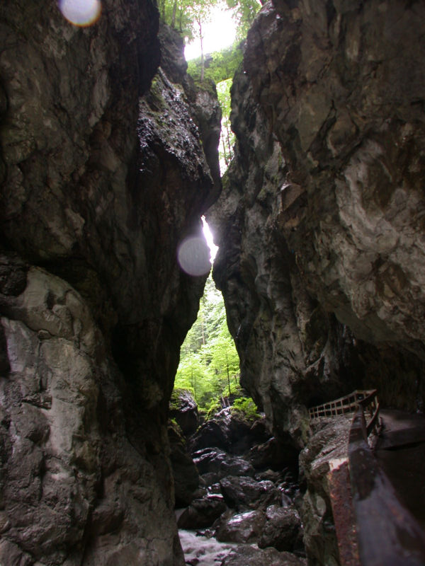
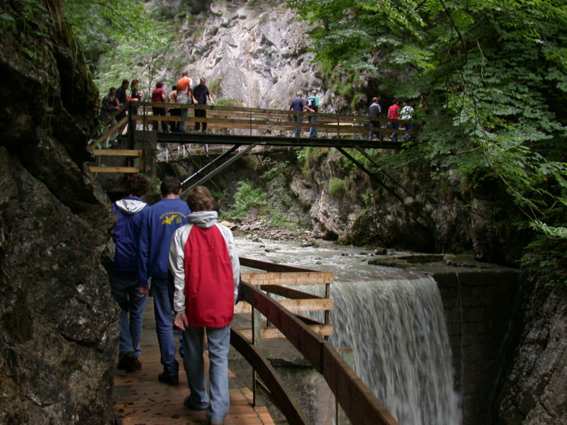
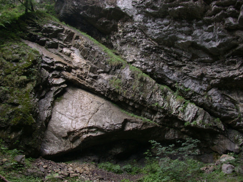
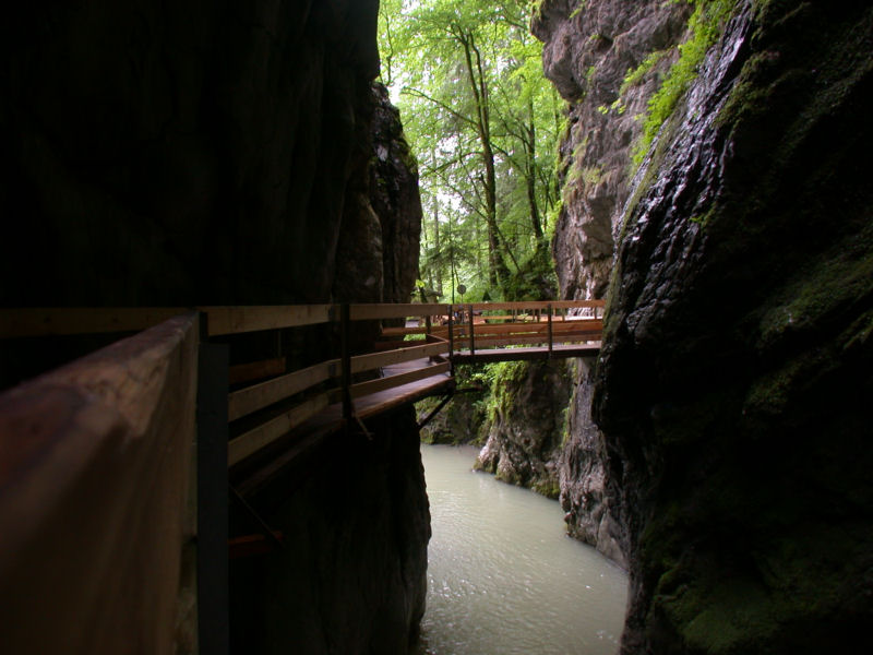
The Rappenlochschlucht is a fantastic gorge, although not as long or as bombastic as some others nearby. On the other hand it is free, an easy walk, and a great fun for children. As always gorges are a fine place on a hot summer day. Unfortunately there are many others who may have the same idea.
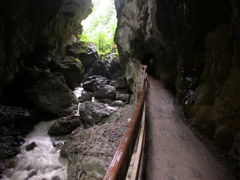
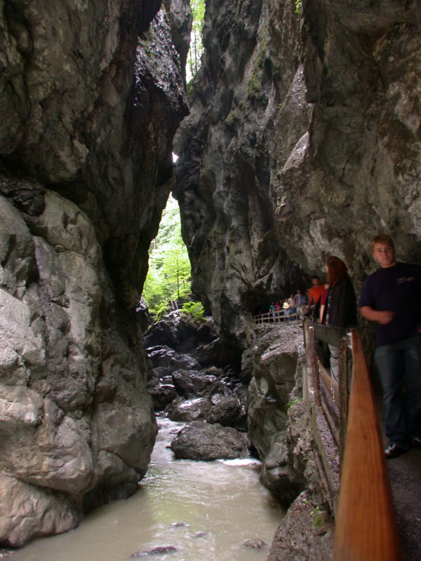
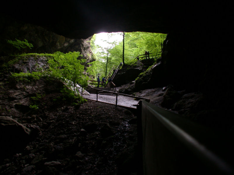
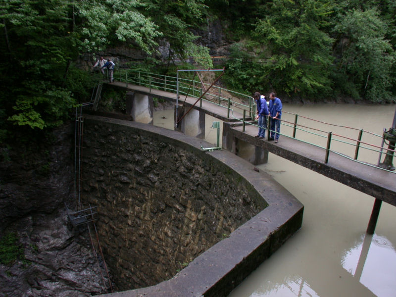
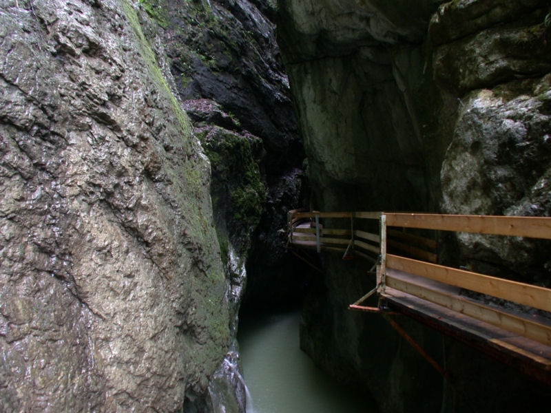
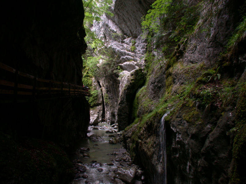
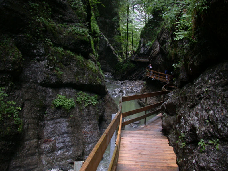
The Rappenlochschlucht is located in the city Dornbirn. It is well signposted, located at the road into the valley of the small village Ebnit. There is a parking lot and a huge mammoth tree. Following the huge cast iron water tube the visitor soon reaches the first part of the gorge which is called Rappenloch. This name became synonymous for the whole complex of three gorges. At the end of the gorge the valley widens, a dam with an artificial lake follows, the building of the second-oldest hydroelectric power plant in Vorarlberg, then the Alplochschlucht. It is almost as impressive as the first flume.
The third gorge, the Schaufelschlucht is not developed with a trail, but it is the location of a road. The road from Dornbirn to Ebnit crosses this gorge, with several bridges, tunnels and avalanche shelters. This is probably the alternative for lazy visitors. However, the road is very narrow and requires a certain amount of driving skill.
The Rappenloch Gorge was developed early on for the use of hydropower. Two dams were built for this purpose in the 19th century. The first was built in 1829 at the lower end of the gorge, based on plans by Kreiswasserbauadjunkt Franz Alois Negrelli, hydraulic engineer for the district of Vorarlberg. It supplied water to a small industrial estate called Gütle via a pressure water pipe. The second dam, between the Rappenloch Gorge and the Alploch Gorge, was built in 1861. This Rappenlochschluchtsperre (Rappenloch Gorge Dam) dammed up the Staufensee reservoir and also transported water to Gütle via a pressure water pipe. A path was built through the Rappenloch Gorge for this purpose. However, the dam was primarily built to regulate water flow in order to support timber floating. The excess water was used for what was then Europe’s highest fountain, built in Gütle in 1869. Hydropower was traditionally used to drive water wheels. The path through the gorge had existed since 1861, but it was only used for maintenance of the hydropower installations and was not open to the public.
It was not until 1898 that the Ebensand hydroelectric power plant, the second-oldest power plant in Vorarlberg, was built. The small run-of-river power plant supplies around 7 GWh annually and is still in operation today. Although it is located above the Staufensee lake at the entrance to the Alploch Gorge, its dam wall was reinforced and renovated. The water for the power station is fed through a two-kilometre-long penstock tunnel with 13 tunnel windows. The tunnel has a cross-sectional area of 2.1 m² and can store 4400 m³ of water.
It was not until 1902 that the maintenance path was opened to hikers, and it quickly developed into an important tourist destination. The Alpine floods of 2005 caused only moderate damage in the Rappenloch Gorge, with one small bridge being destroyed. In general, the gorge is relatively wide and the paths are far enough above the stream, so damage is rare.
However, on 10-MAY-2011, there was a massive rockfall. The Rappenloch Bridge was destroyed, the flow through the gorge was blocked and the paths in the gorge were buried under 15,000 m³ of rock. In particular, the flow is still so disrupted today that the reservoir is increasingly silting up because debris is no longer being transported away. The village of Ebnit could only be reached on foot, so a military D-bridge was erected within five weeks. It was not until 2013 that a completely new footbridge was opened, leading through the gorge above the rockfall.
On 19-MAR-2020, another rockfall occurred very close to the temporary bridge. This closed the gorge again, as well as the road. The temporary bridge was dismantled and the road down to the reservoir was upgraded. This meant that it was possible to drive down one side, cross the river on a new bridge at the Ebensand power station and rejoin the road via the access road to the power station. In 2021, 17,000 m³ of unstable rock was blasted away and a new bridge was built, which was now significantly longer. The bridge was opened in 2023. The pictures on this page are from 2005 and show the condition before the two landslides.
- See also
 Search DuckDuckGo for "Rappenlochschlucht"
 Google Earth Placemark
 Rappenlochschlucht - Wikipedia (visited: 06-NOV-2025)
 Rappenlochschlucht und Alplochschlucht, official website (visited: 06-NOV-2025)
- Rappenlochschlucht in Dornbirn mit der Alplochschlucht (visited: 06-NOV-2025)
- Rappenlochschlucht (visited: 06-NOV-2025)

 Index
Index Topics
 Hierarchical
 Countries
 Maps
Maps