Córdoba Province


Córdoba is located in the center of the country and with Santa Fe and Entre Ríos forms the Center Region. An extensive plain covering the eastern two thirds of the province has not much to offer on underground sights. The Sierras de Córdoba are three mountain ranges, between 1,000 m asl in the south and 2,000 m asl in the north. The three mountain ridges have two valleys, the Calamuchita valley in the south, and the Punilla Valley in the north. Most of the tourist spots in the province are located here.
The area of the Sierras de Córdoba has mostly crystalline rocks, mostly granites, but also red, quartz rich sandstone. There is no karst, but nevertheless there are four underground rivers which have some fame. Three are offered on cave trekking tours, the Wildbach stream in La Cumbrecita, the La Posta river in Mina Clavero, and on a tributary of the Yuspe river in Los Gigantes. The fourth is La Bestia, 28 km from Tanti in the Los Gigantes area, which is considered too dangerous and is not open to the public. Unfortunately there is no official company doing the tours, it seems when tourist groups are interested they contact the local tourist office, which organizes guides. The caves are very hard to reach, in general two hours walk or even a one to two hour ride on horseback (which is considered part of the adventure). For our opinion those tours are too far on disorganized-death-trap side, so we decided not to list them.
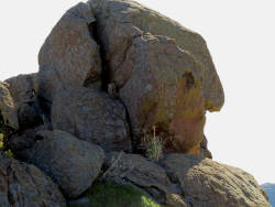
Nevertheless, we want to explain them. Its quite exceptional to have caves in areas with non-soluble rocks. Even more exceptional is that all of them are river caves, but thats actually part of the explanation. Granite weathers in a quite typical way which is called spheroidal weathering. The granite cools very slowly, but it gets crack because its volume decreases. Those cracks are used by the water to dissolve the rocks widening the cracks, cuting the solid rock into separate, rounded blocks. The rivers in those areas flow through such cracks and widen and deepen them. Sometimes they are not stable any more and the blocks on the side stumble into the gorge, covering it with debris. But there are still a lot of cracks and the water of the river now flows through the cracks, removing smaller and loose pieces of rock and creating a river cave. Such caves look like walking through huge boulders and are completely devoid of speleothems. The three caves have a quite spectacular length between 100 m and 300 m, definitely exceptional for this kind of cave.
 Cavernas El Sauce
 Cueva de Los Pajaritos
 Gruta de la Virgen de la Medalla Milagrosa
 Las grutas de Ongamira
- See also
 Search DuckDuckGo for "Córdoba Province"
 Córdoba Province, Argentina - Wikipedia (visited: 04-NOV-2020)
 Ríos subterráneos para conocer en Córdoba: tres tesoros bajo tierra
  (visited: 08-NOV-2020)
 Descubren Un Río Subterráneo En El Valle De Los Lisos A 28 Kilómetros De Tanti
  (visited: 08-NOV-2020)
 Index
Index Topics
 Hierarchical
 Countries
 Maps
Maps