Geology of Brazil
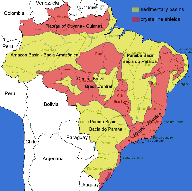
The geology of Brazil is characterized by very old precambrian crystalline shields, which cover 36 percent of the territory. The principal mountain ranges average elevations under 2,000 meters, like the Serra do Mar Range along the Atlantic coast, and the Serra do Espinhaço Range in the south-central part of the country. The highest ranges are the Tumucumaque, Pacaraima, and Imeri ranges along the northern border with Venezuela and the Guianas. But this mountains cover only 0.5% of the country, most of it is covered by the Planalto Central, a vast central plateau at about 1000 m asl, the crystalline shield. The rest of the territory is made up primarily of sedimentary basins. The largest sedimentary basin to the north is drained by the Amazon and its tributaries and the Tocantins-Araguaia. Others are drained southwards by mighty but less known rivers like the Javari, Juruá, Purus, Madeira, Tapajós, Xingu, and Tocantins.
The sedimentary basins contain numerous soluble rocks like limestone, dolomite and gypsum. The high precipitation and the high temperatures make karst very common and often very impressive, with caves of enormous size. And sometimes karst even develops in rocks which are not soluble under normal conditions, like granite. The granite karst of Brazil is legendary. This means karst is not restricted to the sedimentary basins but also occurs in the crystalline shields.
On the other hand mining concentrates on the crystalline shield, because long ago various orogenies lead to the formation of all kind of mineral and ore deposits. The basement of the South American Platform consists of metamorphic rocks of amphibolite to granulite facies and granitoids of Archean age. There are also Proterozoic units, which are folded strips of green schist facies and several granitoids. This basement is widely exposed in great shields, the shields of Guyana, Central Brazil and Atlantic.
- Additional Information about Brazil
 Search DuckDuckGo for "Brazil Geology"
 Brazil: Geology, Geomorphology, and Drainage
 Index
Index Topics
 Hierarchical
 Countries
 Maps
Maps